Alaska
Alaska is a dream destination for nature lovers, adventurers, anglers, hunters, and, of course, photographers. With over 100,000 glaciers, the highest mountains in North America, and the largest national parks, Alaska is the epitome of wilderness and back country adventure!

BEST OF ALASKA
Alaska is full of bests! My passion is especially for the glaciers and mountains as well as the expansive, untouched wilderness.

Our planning process
We only started planning our trip in mid-July, so, yes, once again at short notice! Our three-week travel window from August 19 to September 8 was fixed and we wanted to book as little in advance as possible, stay flexible, and adapt as much as possible to the weather.
BEST TRAVEL TIME
The best season for landscape photographers is late summer from late August to mid-September. The birch, larch, and cottonwood trees and the fields of fireweed are at their most brilliant that time of the year since leaves change color early this far north. You also have a good chance of seeing the Northern Lights (Aurora Borealis). Unfortunately, the season only lasts two to three weeks.
While the fall colors had already started by mid-August in 2017, the warm summer in 2018 postponed their arrival considerably. When we visited Denali National Park, for example, everything was still quite green. Many campsites and park services do cease operations for winter by mid-September, making the optimal travel window quite short and requiring careful planning.
The more flexible, the better
A few reservations are nevertheless absolutely necessary, such as the campsite at Wonder Lake. The 28 campsites are particularly popular with photographers and are usually booked several months in advance. Even before we booked our flight to Alaska, we reserved the one and only free date at Wonder Lake. We were very lucky, although 2-3 nights would have been even better.
Another reservation in advance was the one we made for the multi-day kayak tour at Columbia Glacier. But that was it for our advance reservations; everything else we organized spontaneously on the spot.
If you visit Alaska in high season (July), you will need to do a lot more advance planning and booking. The prices for rental cars and accommodation are also higher during this period than at the end of August in the so-called shoulder season.
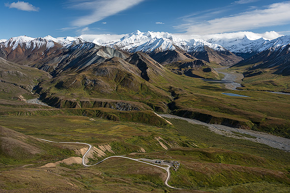
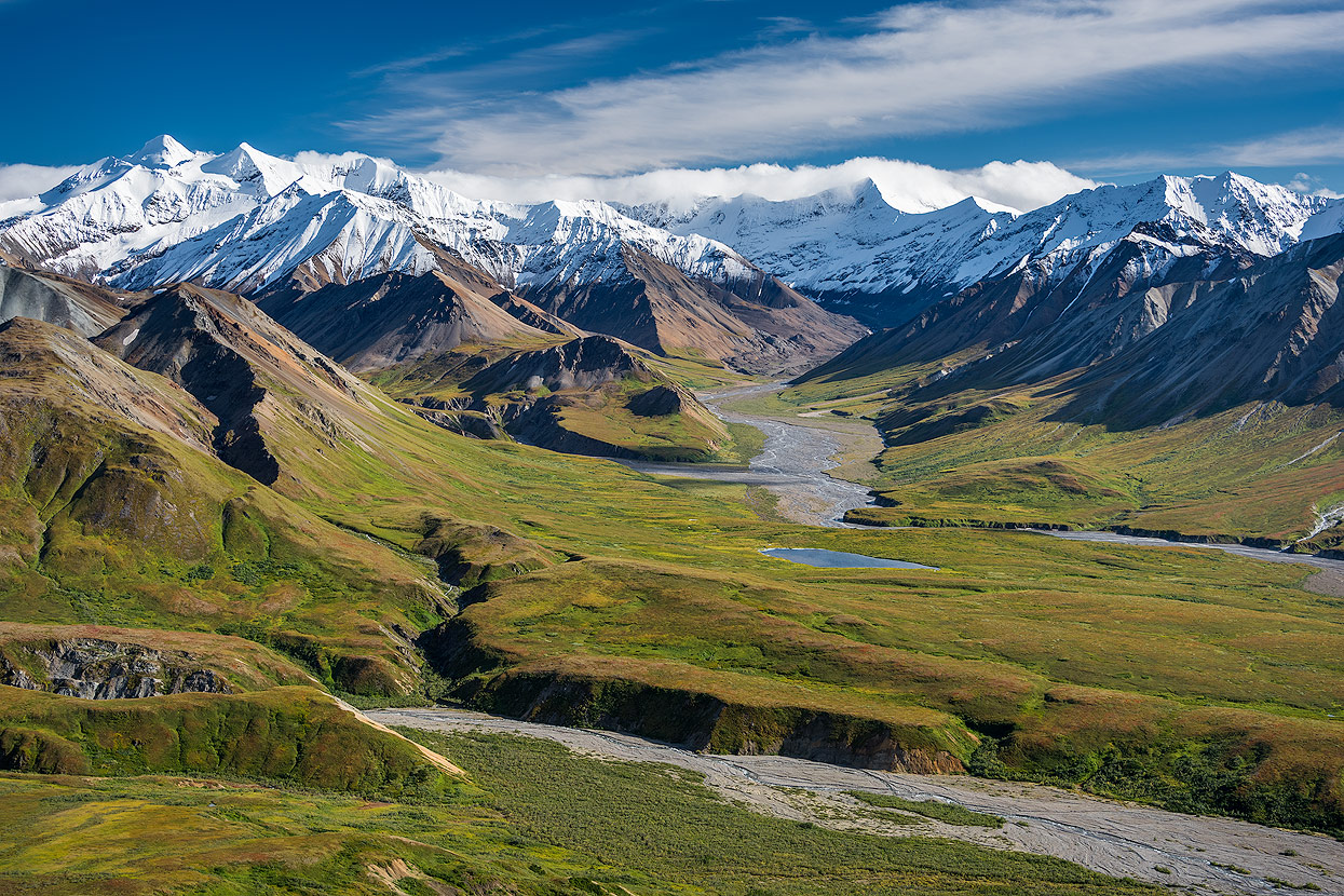
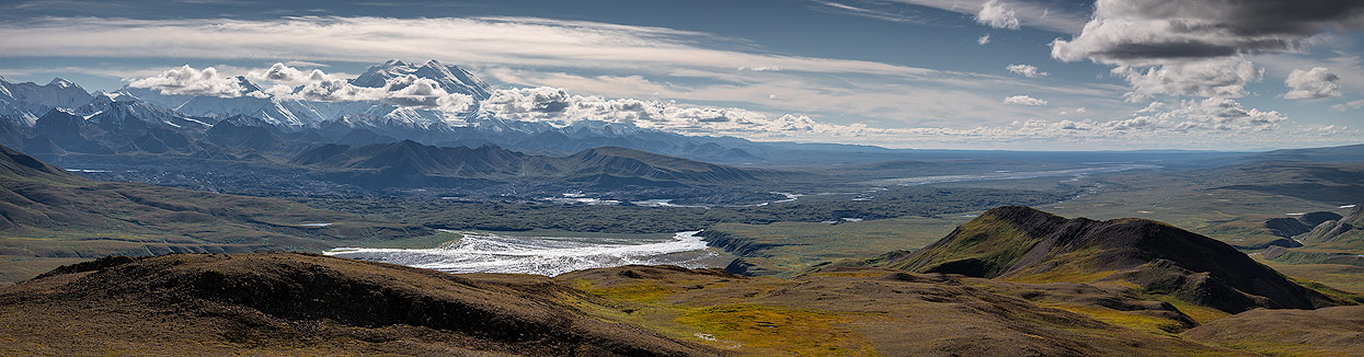
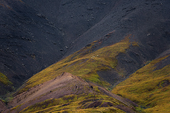
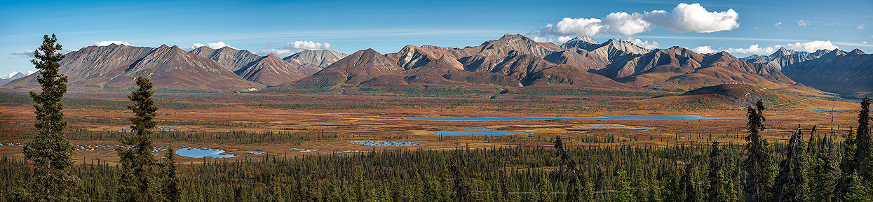
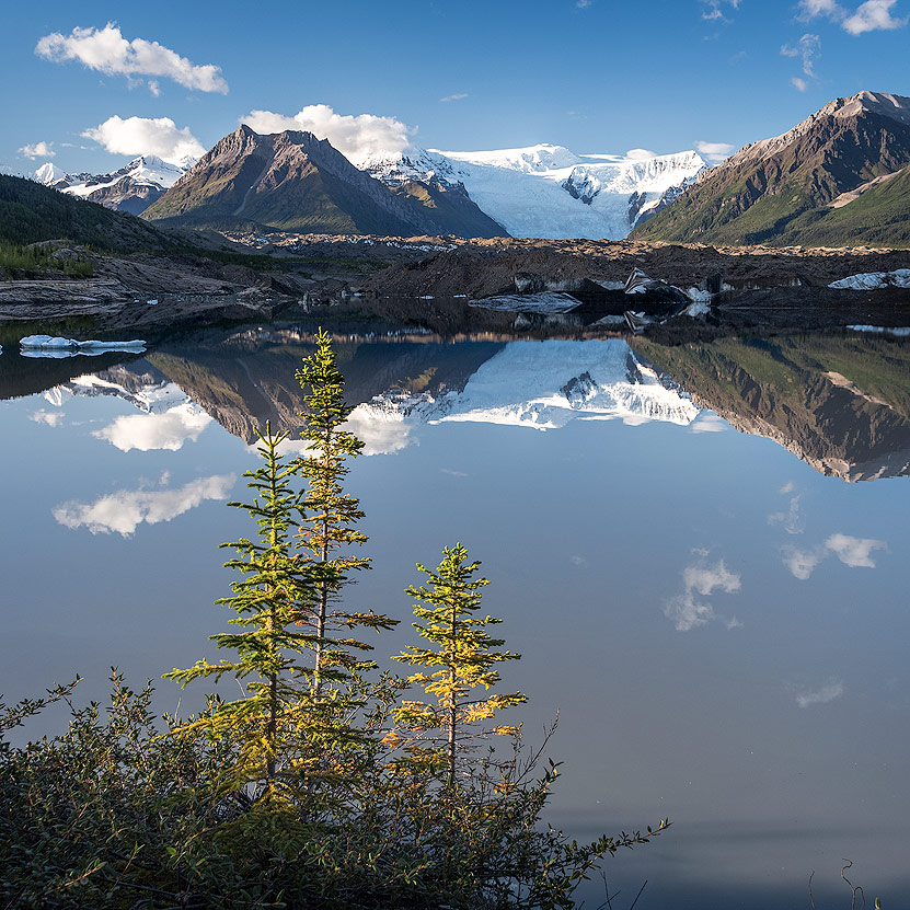
Denali National Park
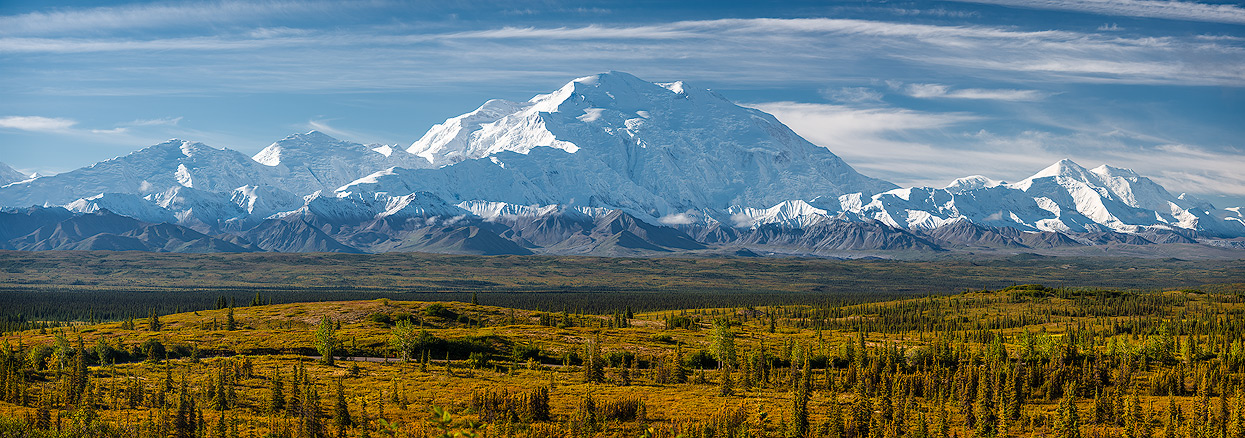
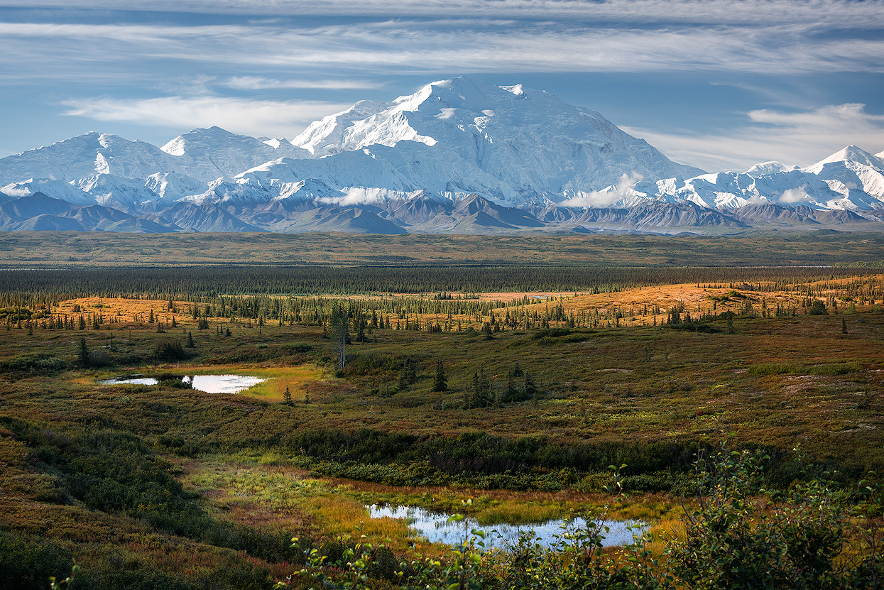
Almost everything in Alaska is big! "The Great One" is the English for the Koyukon Athabascan name Denali recently restored to the former Mt. McKinley. At 20,310 feet above sea level, it is the highest mountain in North America and one of the Seven Summits, the highest mountains on each of the seven continents.
A mountain of superlatives and extremes
The Koyukon Athabaska named the mountain Denali, "the Great One" or "the High One," and it plays a central role in their creation story. It was previously called Mt. McKinley, after the assassinated 25th President of the United States. This monumental elevation combines all sorts of superlatives: it is the northernmost mountain on the planet over 5,000 m (3.10 miles) and the highest mountain in North America. It soars over 13,000 feet above its surrounding landscape; none of the surrounding mountains are anywhere close in height.
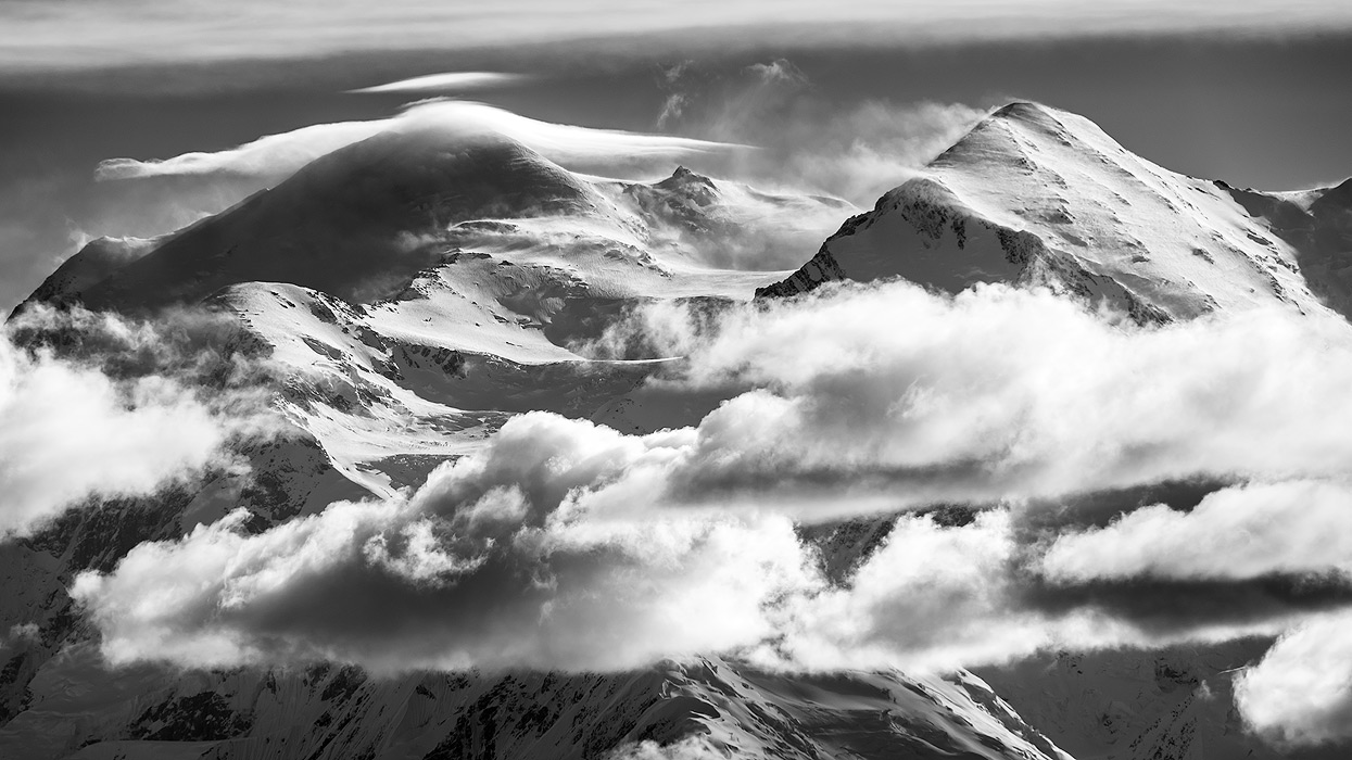
Denali is also considered to be the coldest mountain in the world. Temperatures of -40°F even in summer are not uncommon. The rapidly changing weather and the incredibly strong winds direct from the North Pole make for an extreme climate. Due to its northern location, the partial pressure of the oxygen on the summit is like that in the Himalayas, a couple thousand feet higher up.
Unlike in Central Asia, though, there are no sherpas here in Alaska and climbing Denali is very strenuous and time-consuming. Indeed, the mountain is considered extremely difficult and dangerous, even among experienced mountaineers.
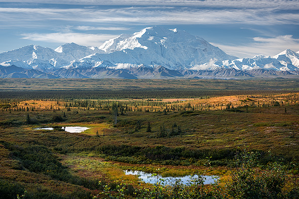
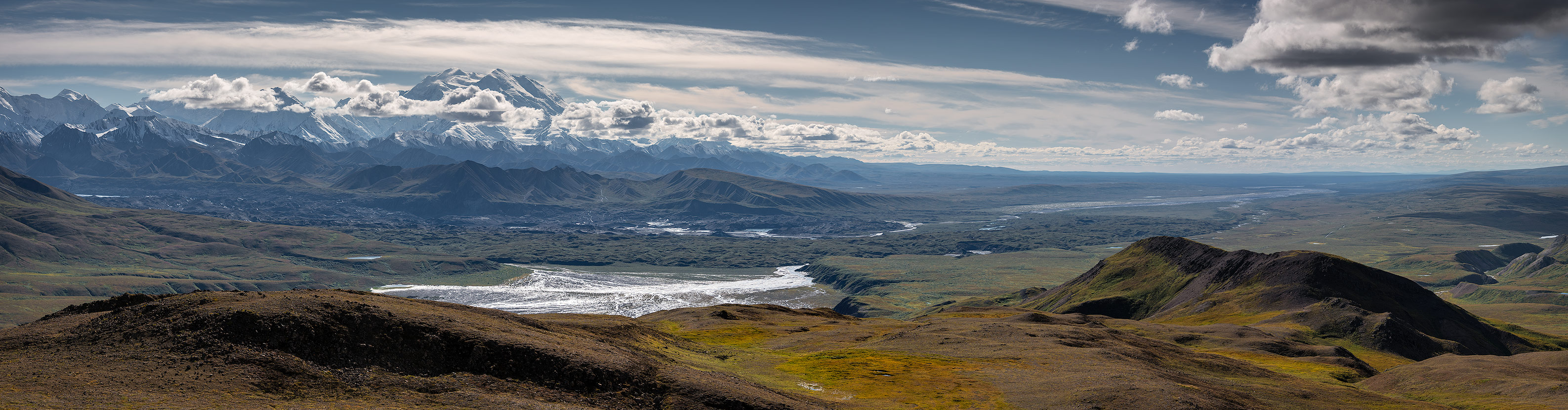
Due to its enormous presence, though, Denali is an absolutely majestic and impressive sight even from a great distance! The best views from the highway can be had from two marked turnouts. The summit is almost always enveloped in cloud cover, only visible maybe 30 days a year.
A rush of visitors
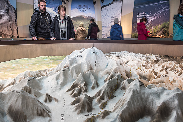
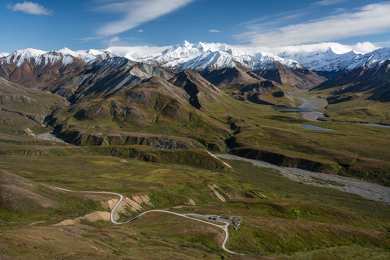
With over 400,000 visitors per year, Denali National Park is one of the most visited parks in the world. Tourists come here from all over the world to see the mountain and experience the 9,375 square miles of wilderness. There is only a single 85-mile road into the park and, although you might think that this would lead to massive traffic jams, this is fortunately not the case because crowd controls are in place to protect the park. Basically, visitors have two options if they want to spend more than one day in the park: either find a place to stay in the surrounding area or try to get one of the few campground spots in the park.
From A to B
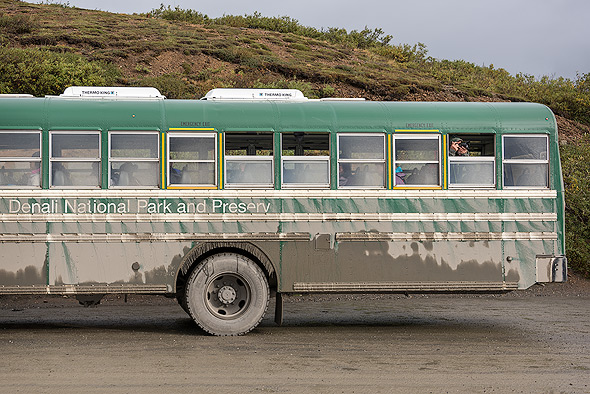
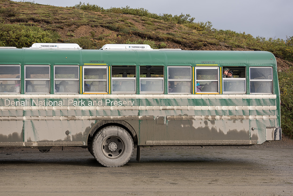
While you can drive the first fifteen miles into the park with your own vehicle, you will have to park it and board a park bus to continue your journey. When I first read about this arrangement, I have to admit I was quite skeptical. Which photographer wants to be driven around in buses: I'd rather drive myself and stop where I want!
But the transport system with the long and somewhat rickety-looking buses works well and the drivers are almost without exception friendly and helpful, stopping on request and also keeping an eye out for bears, moose, etc. You can disembark wherever you like: just holler "Stop!" and the driver will pull over and let you out. Getting back on board is just as easy: just stand at the side of the road and wave a bus down.
Camper Bus
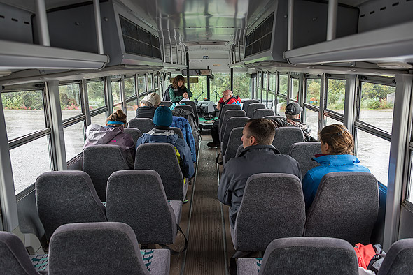
If you have reserved a tent site, you can buy a ticket for the camper buses. We had to order this ticket in advance by calling, so the sooner the better!
The advantage of the camper buses is that they are much less busy than the normal buses for day tourists. This is especially handy with a lot of photo equipment in tow. The camper bus pass costs around $55 and can be used for your whole stay. Provided, of course, that you can show proof of a campsite reservation.
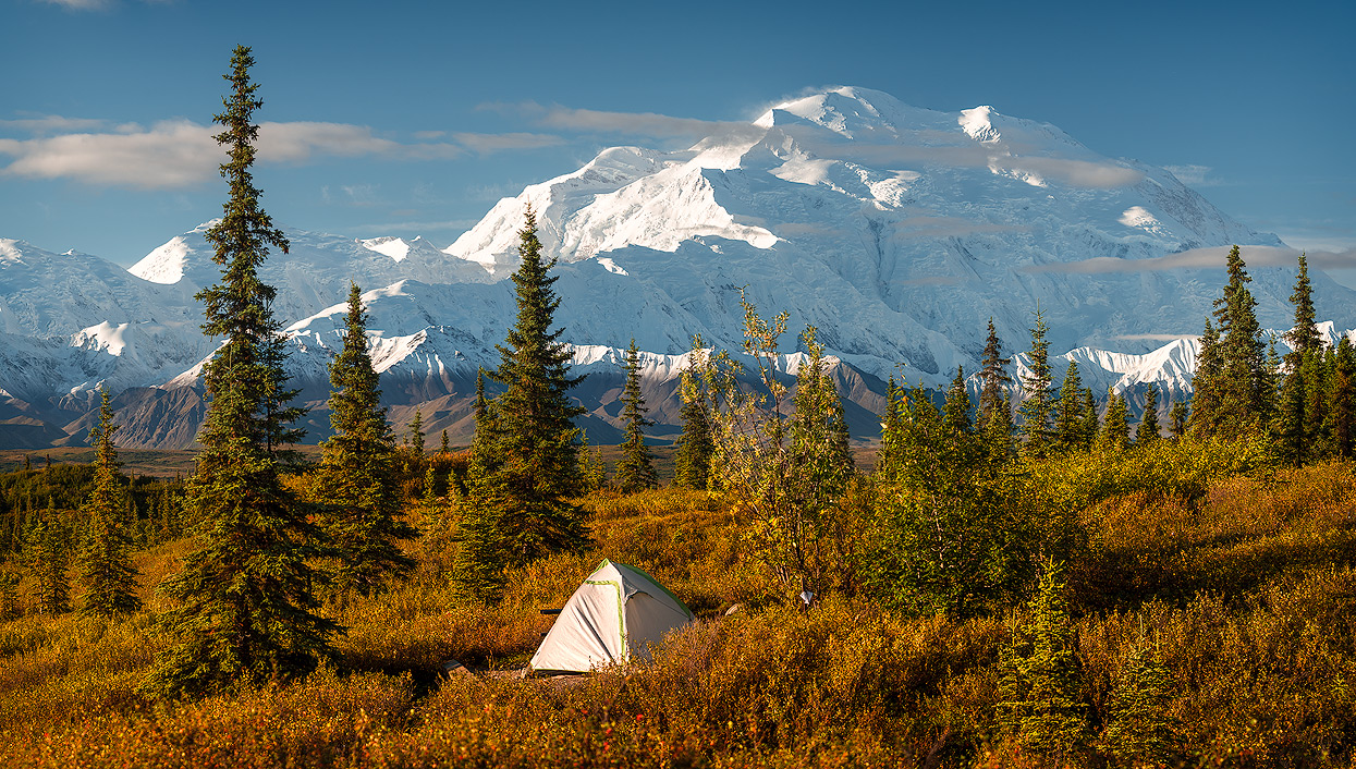
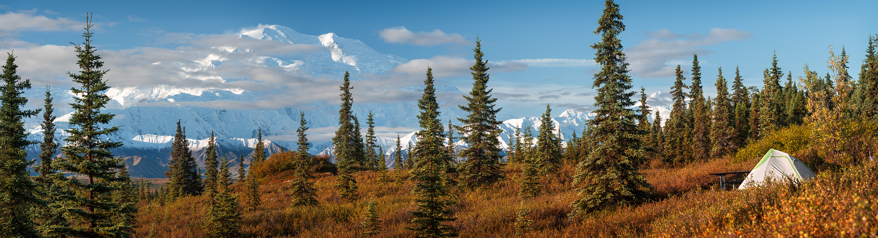
The most scenic campground in the park: Wonder Lake
There are several campsites along the 85 mile road. We spent one night each at Riley Creek, Savage River, and Wonder Lake. Without a doubt, the highlight was Wonder Lake campground! Nowhere are you closer to the mountain than here and the views are simply fantastic.

Ideally, you should book a couple days at Wonder Lake, well in advance. The 28 spots are usually booked up quickly and the campsite closes for the season by mid-September. I even ran into people who had been at Wonder Lake for 14 days. It goes without saying that they were running around with 600 mm lenses. The trip to Wonder Lake takes about 5-6 hours (round trip 11 hours). The bus goes directly from the park entrance to the campsite, allowing you to take really large, bulky bags with you. It's a good thing that there are no luggage limits for the camper buses!
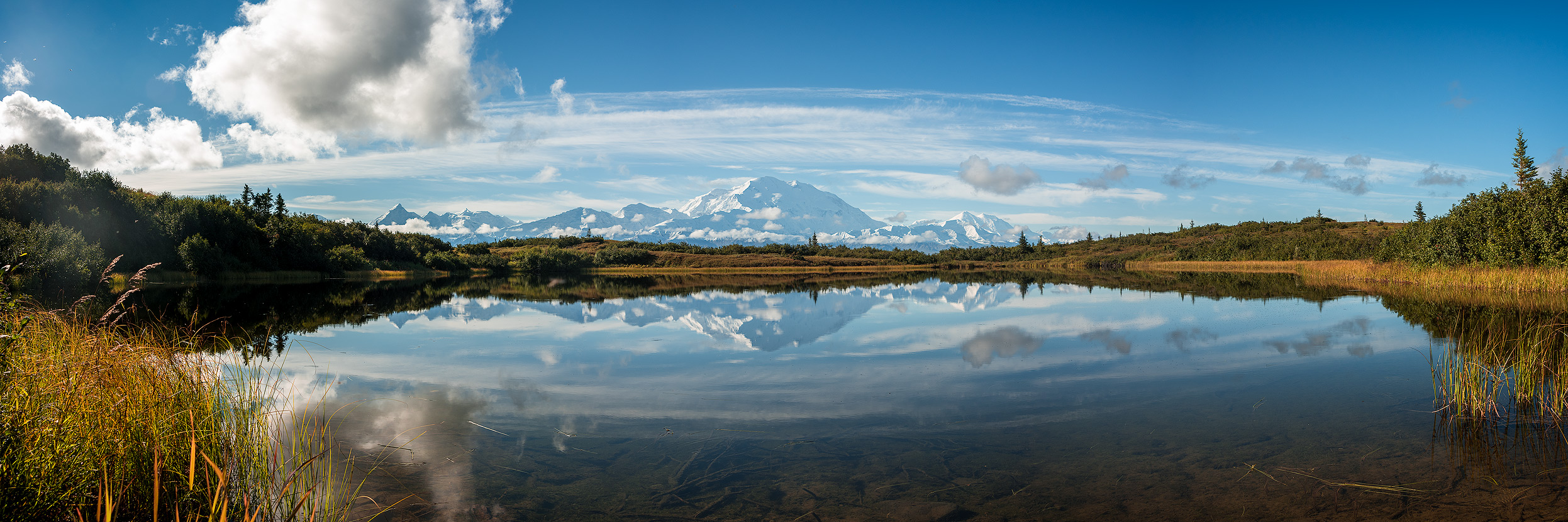
Reflection Pond

One of the most iconic and often-photographed images of Denali is from Reflection Pond, just beyond mile 85. The Kantishna transit bus and Kantishna Experience tour will take you past Reflection Pond. If you are on a Wonder Lake-specific bus or stay at the Wonder Lake campground, be prepared to walk over two miles to reach Reflection Pond. It’s worth going up there in the early morning. Just follow the road to Kantishna.
Polychrome Pass
Polychrome Pass Overlook (Mile 46) is a rest stop for the shuttle buses, and is named for its exposed band of multihued rock strata. This scenic area, at 1’000m, has the sort of dramatic views of the Toklat River.
Eielson Alpine Trail
Eielson visitor center (Mile 66) is the most common turning-around point for day-trippers taking the shuttle or tour buses into the park. A walkway extends around the center, affording mind-boggling views of the Toklat River, nearby mountains and, if the weather gods are smiling upon you, Denali itself.
When you're ready to hit the trail, cross the road and you can't miss the trail that goes uphill. This trail goes up over 1,000 feet in one mile. When you get to the top, you can walk along the ridgeline to get some different views. If Denali is out, I can't imagine a cooler place to be. If the mountain is covered by clouds, you'll still have some awesome views below of the visitor center and distant river valleys.
Finding Denali
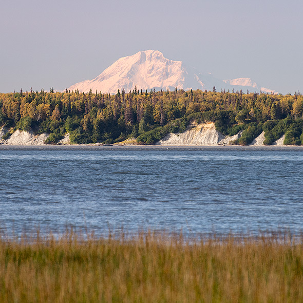
Anchorage
On a clear day, chances are you’ll be able to see the Alaskan Range from Anchorage. Drive to Earthquake Park, and look north to see Denali, North America’s highest peak, 215 km away. You can see Denali from nearly any high viewpoint on the north side of Anchorage.
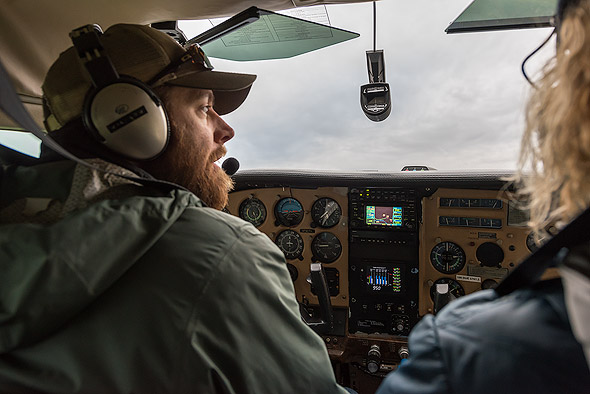
Talkeetna
Visitors can see the mountain up close on a flightseeing tour from the local airstrip. Scenic flights of the mountain and the Alaska Range are awe-inspiring and many offer glacier landings as well. At times, passengers even catch a glimpse of climbing parties en route to the summit.
Talkeetna: a hub for climbers, tourists, and idiosyncratic Alaskans with a slightly crunchier take on the state’s ‚Do what you will‘ libertarian mindset. (Source: Lonely Planet)
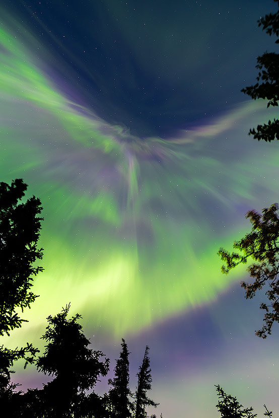
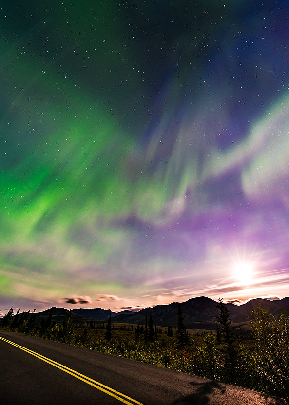
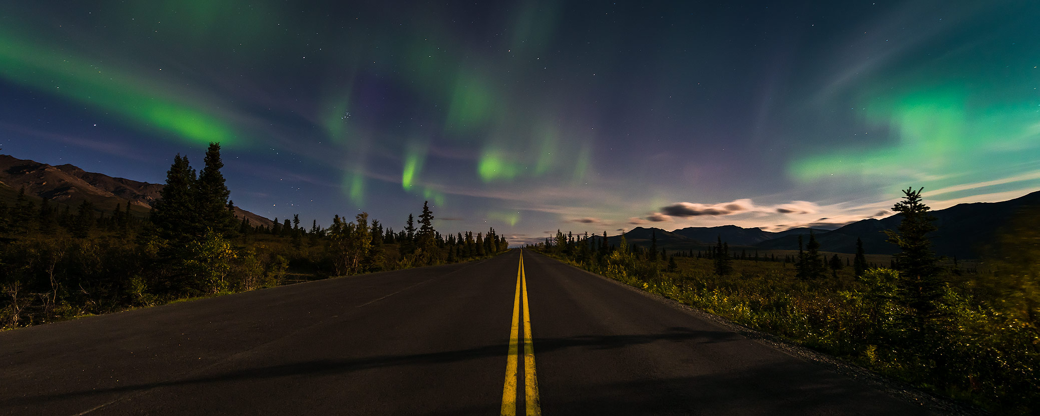
Northern lights
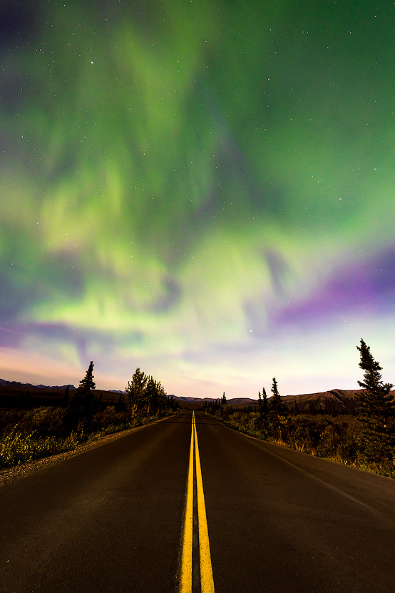
Another Alaska highlight is the Northern Lights. The region around Fairbanks is perfectly located to see them; the sky is already dark enough in mid-August to see the natural spectacle. This is another reason to visit Alaska during the "shoulder season." It is also worth spending a night or two outside waiting for the lights.
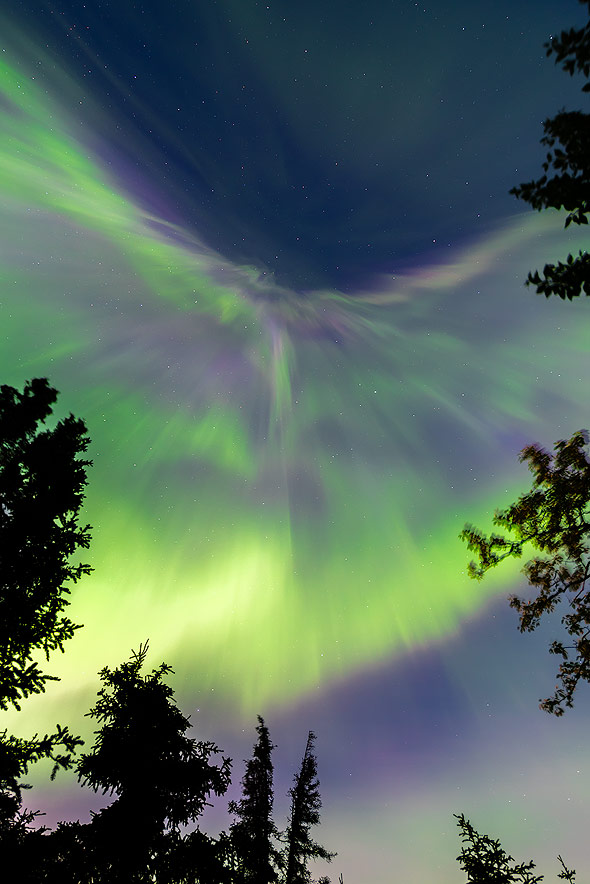
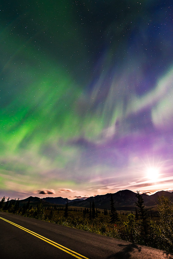
I was checking the weather forecast and the «space weather conditions» whenever I could manage to get a signal. I had the feeling that not a single American was following the weather forecast. Is it really just a Swiss thing to know the exact forecast for the next few days? In any case, the predictions on Meteoblue and SRF Meteo were very good, so I set the alarm clock at least once night if clear skies, cold temperatures, and KP levels from level 3 were predicted. But we had the most beautiful northern lights at full moon in Denali National Park. We had just returned from the Wonder Lake Campground and were staying at the Savage River Campground when the natural spectacle started!

We could hardly believe our luck, so that for about half an hour we just lay our heads in the neck and were amazed. As it turned out, taking photos was less important to me; I just wanted to enjoy the moment and look up into the sky. I had seen Northern Lights in Lofoten and a few in Iceland, but this was a different intensity! The threads came in spirals (red/yellow on top, green below) directly towards us. It was unbelievable and one of the most beautiful experiences we had on our journey!
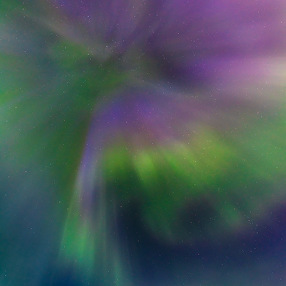
Just before the most intense phase was over, I did manage to snap a few shots. But the results are nothing like the live experience. We then drove a few miles away from the campsite and from the tall trees, but the intensity had already dropped significantly by then.
When a few hours later only a few shimmering green stripes were visible on the horizon, we returned to our ten with a big grin on our faces and only then noticed how cold our fingers and feet were. What a day! First the beautiful sunrise on Wonder Lake with a view of Denali and then an evening with the dancing green and red Northern Lights. It will be a day we will never forget!
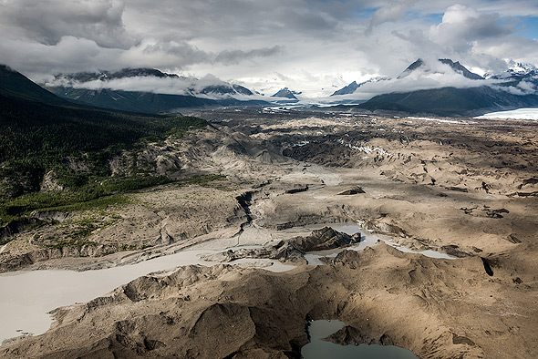
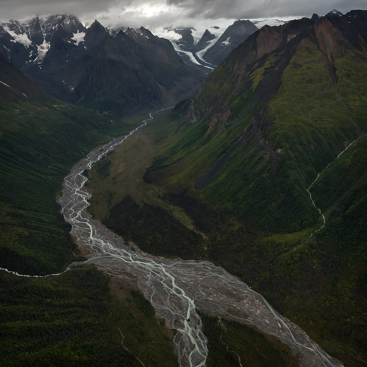
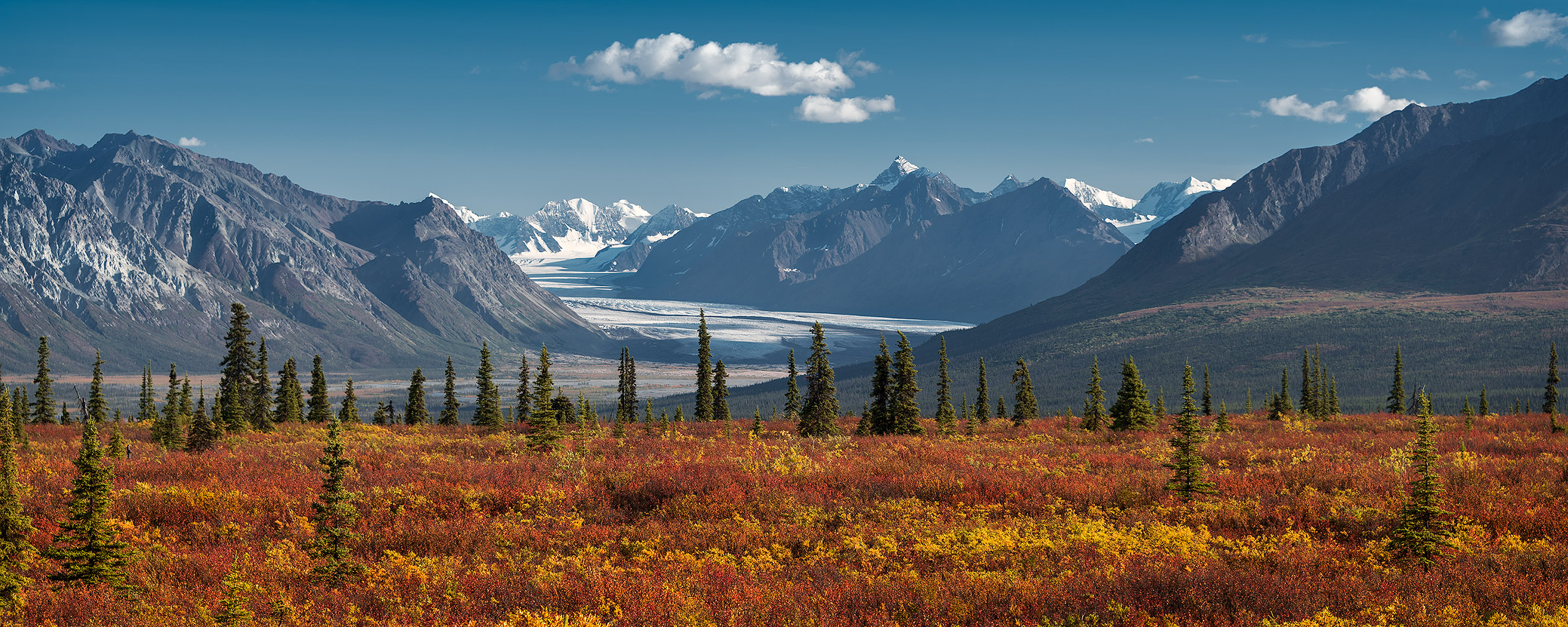
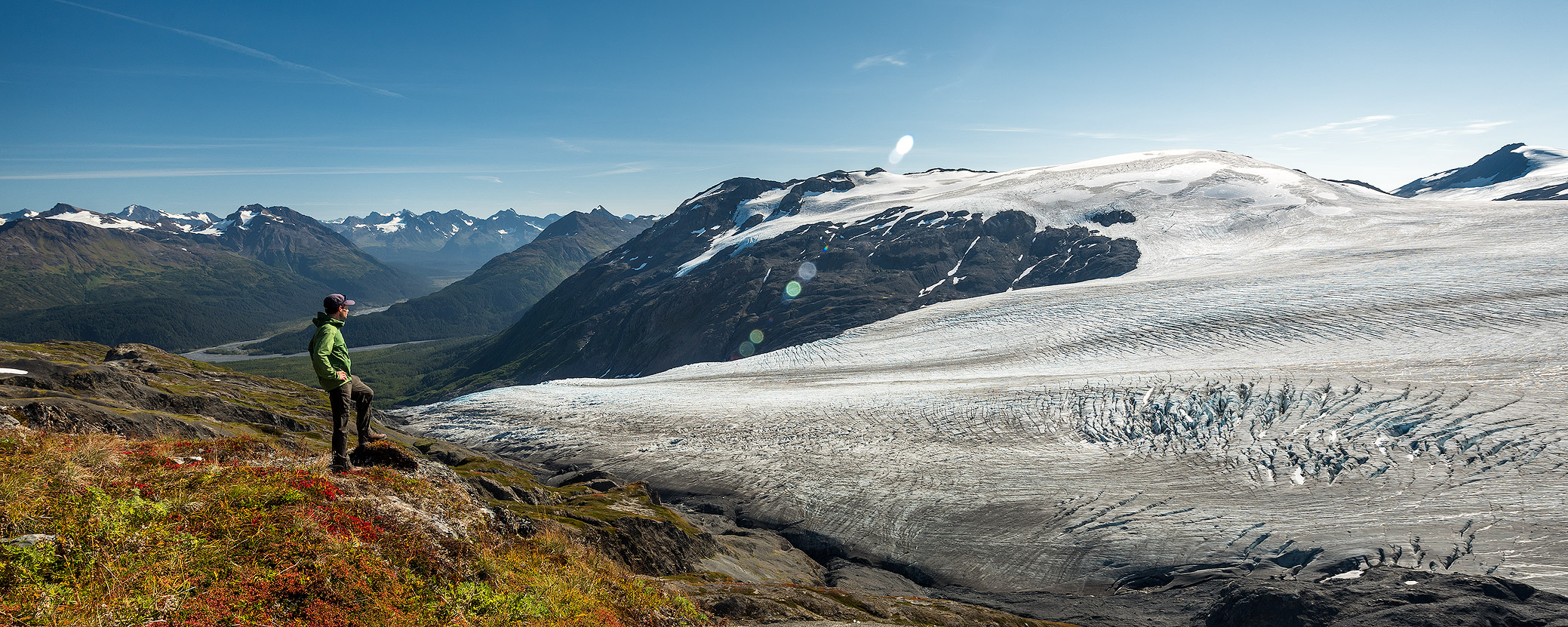
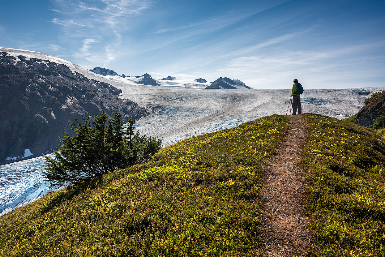
Wrangell-St. Elias Nationalpark
Alaska is much more than "just" Denali, of course! The relatively unknown Wrangell-St. Elias National Park in southeastern Alaska is the largest national park in the United States and is itself almost 4,000 square miles larger than all of Switzerland. A true paradise for back country adventures!
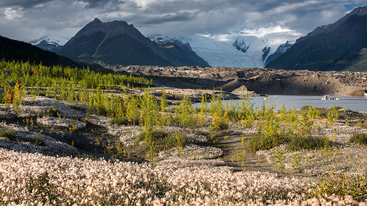
Imagine an area the size of Switzerland. Now strip away its road networks, eradicate its towns and cities and take away all but 40 of its eight million people. The result would be something approximating Wrangell-St. Elias National Park. (Source: Lonely Planet)
Nine of the 16 highest peaks in the United States. Four major mountain ranges: Wrangell, St. Elias, Chugach and the eastern part of the Alaskan Range. Mt. St. Elias, at 18,008 feet (5,488m), is the second highest peak in the United States. Mt. Wrangell, at 14,163 feet (4,316m), is one of the largest active volcanoes in North America. Nabesna Glacier, at approximately 80 miles (128km), is the longest non-polar valley glacier.
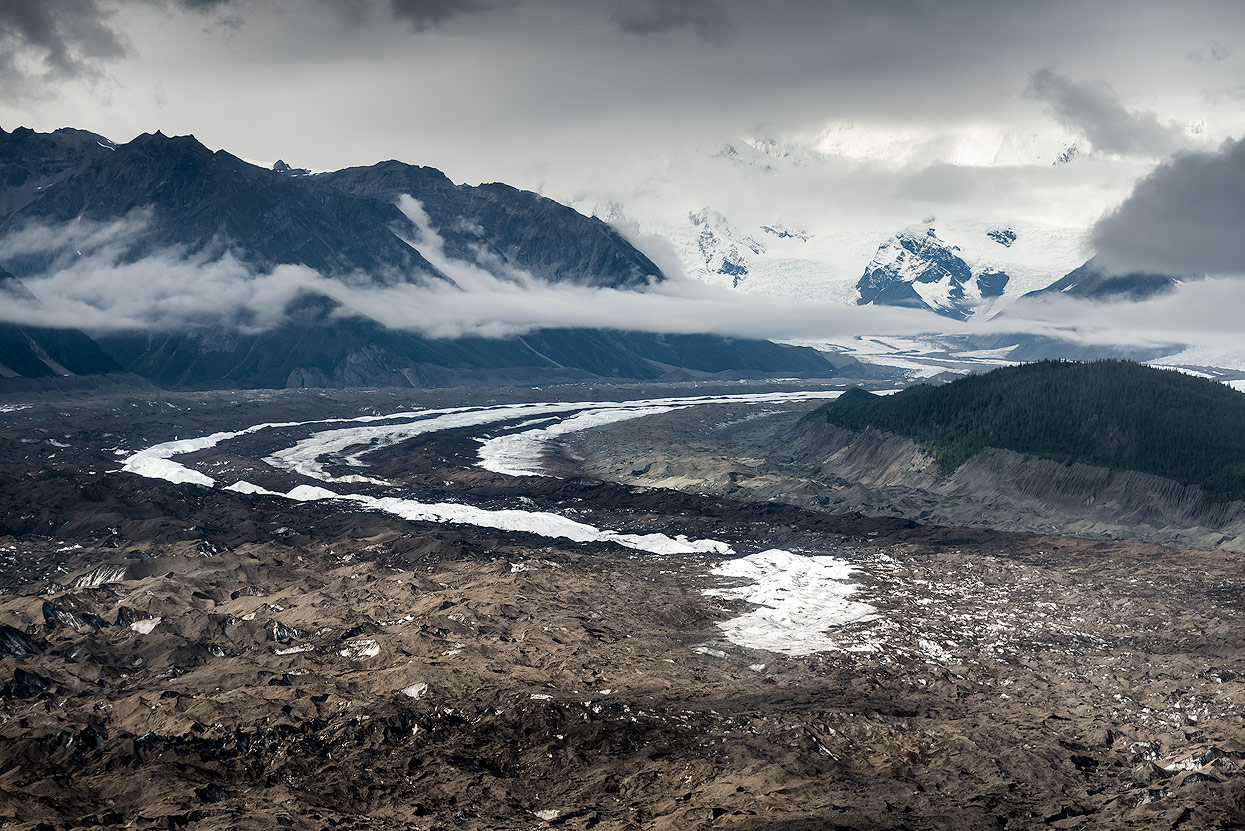
Backcountry Adventures
You’re pretty much on your own when you go hiking or camping in Wrangell-St. Elias. Unlike Denali National Park, you don’t need a permit for camping or for backpacking. There are backcountry itineraries and bear proof food containers are free from Park Visitor Centers. Trails and routes in the park are not necessarily clearly marked, and it’s advisable to use guide services or very established routes to explore and have safe adventures in this truly wild park.
In most places, you have to drop into the trailless backcountry by plane, and then jagged alpine passes and snow-draped volcanoes make for slow going.
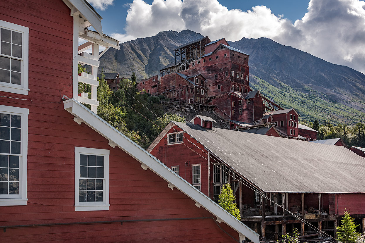
Kennicott Mines National Historic Landmark
Located deep in the heart of Wrangell-St. Elias National Park and Preserve, Kennicott and McCarthy offer visitors a taste of Alaska’s historic mining era and outstanding recreational opportunities.
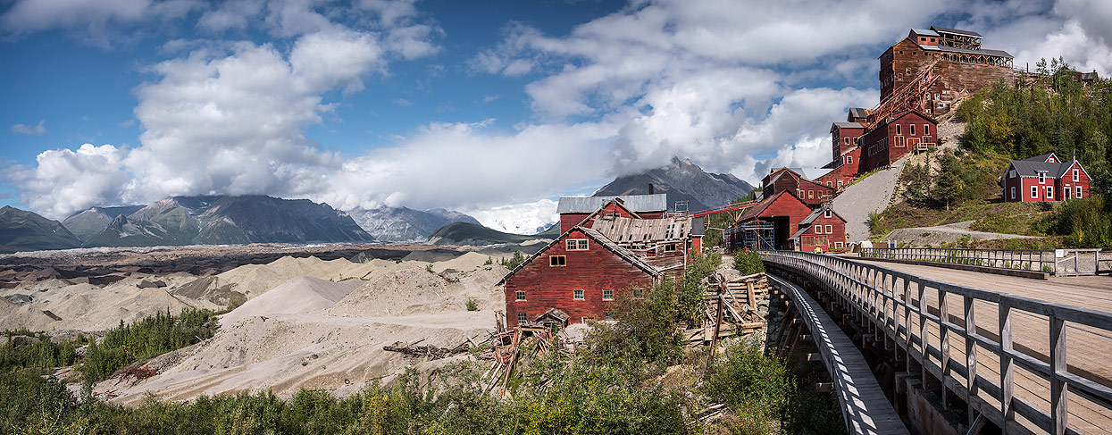
Kennicott and McCarthy sit five miles apart at the end of the McCarthy Road, about 90 miles from the turnoff from the Richardson Highway. Today, Kennicott is a ghost town and McCarthy has a year-round population of just a couple of dozen people. After copper was discovered in the area in 1900, a group of wealthy investors formed the Kennecott Copper Corporation (named when a clerical worker misspelled Kennicott) to mine the incredibly rich veins in the jagged mountains above Root Glacier. The corporation built the Copper River & Northwest Railroad to get the copper ore from Kennicott to the nearest port, in Cordova, and established the company town of Kennicott. From 1911-1938, when the mine was in full operation, the company made more than $100 million.

Since no gambling or drinking were allowed in the company town, nearby McCarthy quickly sprang up as a place where miners could enjoy “wine, women and song,” in its saloons, restaurants, hotels, pool halls, stores, and, yes, a red light district. A number of the buildings from that era are still in use and are listed on the National Register of Historic Places.
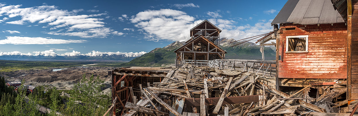
In McCarthy, visitors will find lodging, restaurants, basic services, the interesting McCarthy-Kennecott Historical Museum and outfitters that will take them on a range of activities, from glacier trekking and whitewater rafting to flightseeing trips into the alpine heart of the national park. A shuttle van transports visitors the five miles up the road to the historic mining ruins at Kennicott.

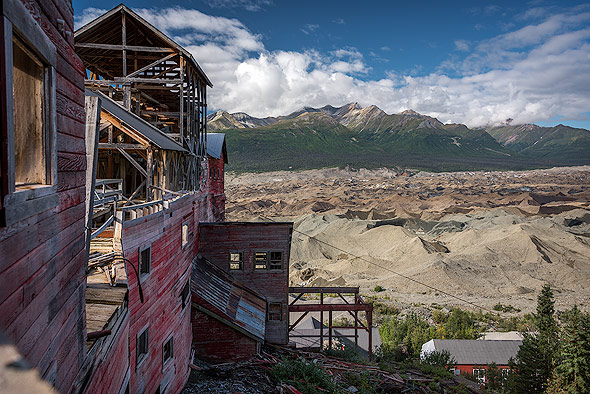
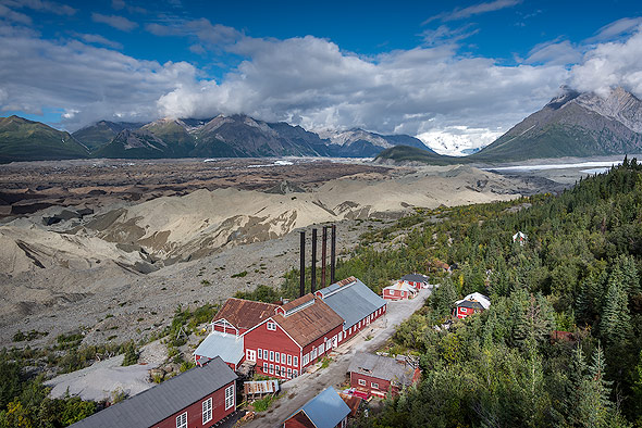
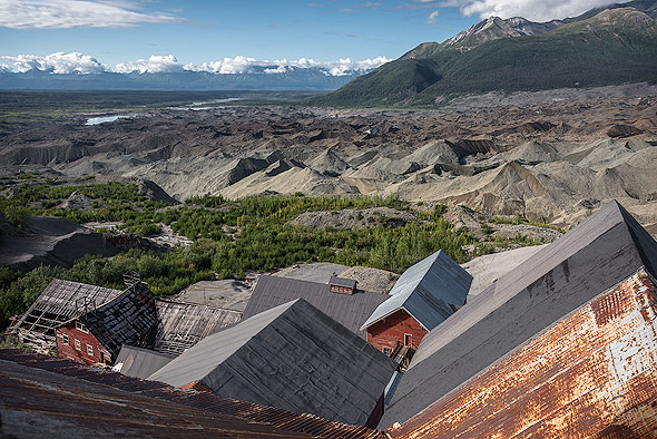
In recent years, the National Park Service has restored most of the mine buildings, and tours of the huge mill building, bunkhouses, a train depot, worker's cottages and the power plant are available. The white-trimmed red buildings stand out against the dramatic mountain-and-glacier backdrop at the mine site and the entire area is a photographer’s dream.
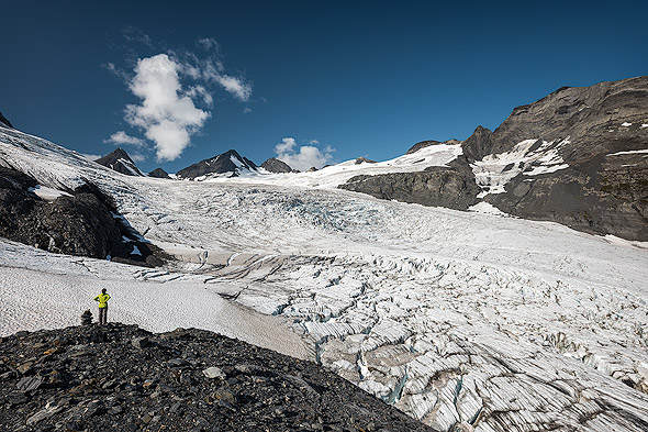
Root Glacier in Kennicott
Several hiking trails depart from near the mine ruins, including the Root Glacier Trail, which leads directly to the surface of Root Glacier, and the Old Mine Trail, a challenging four-mile hike straight up the side of a mountain to the remains of a site where ore was loaded into ore cars and lowered down to the mill buildings below by tram.
Jeanne Morris, who was a little girl then, living in Kennicott while her father worked there, told Bearfoot Magazine:
„The Kennicott Glacier behind our house was so high, we didn’t realize there was a mountain behind it!“
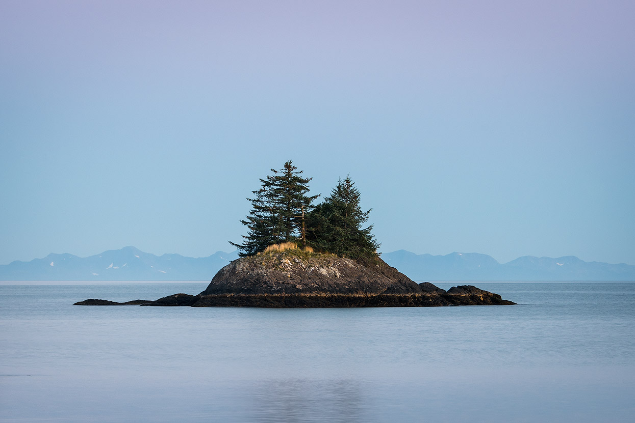
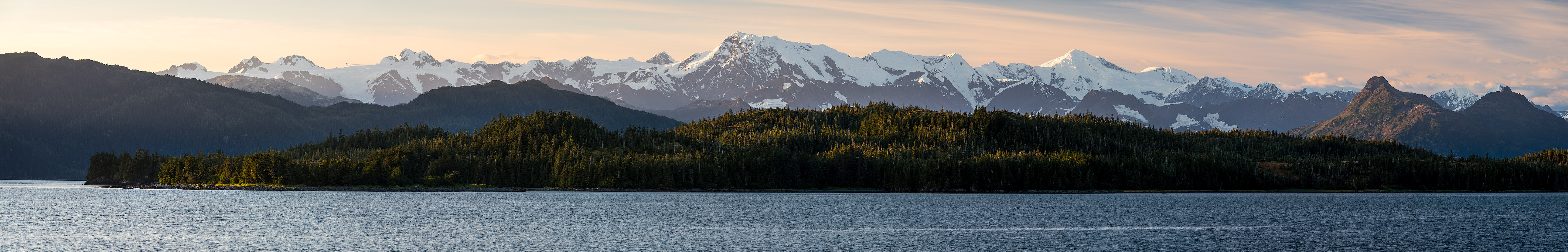
Prince William Sound
Prince William Sound is located in the heart of South Central Alaska. It's the northern extent of the Gulf of Alaska and has some of the most spectacular coastlines and glaciers. Dotted by small islands, the sound is bordered by mountains, glaciers, fjords, rivers, lakes and rain forests.
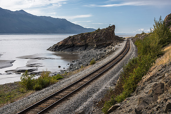
Valdez
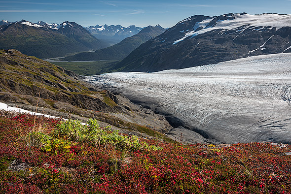
Valdez began with the 1898 Klondike Gold Rush and is now a modern-day port town east of Prince William Sound and surrounded by dramatic views and some of the world's tallest coastal peaks. There are three tidal glaciers close to Valdez. Shoup Glacier is a great for an one day adventure.
Columbia Glacier is farther form town an a tour destination. Even farther from Valdez is Meares Glacier. All three glaciers start in an ice field high in the Chugach Mountains and flow into Prince William Sound.
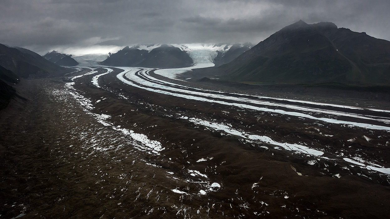
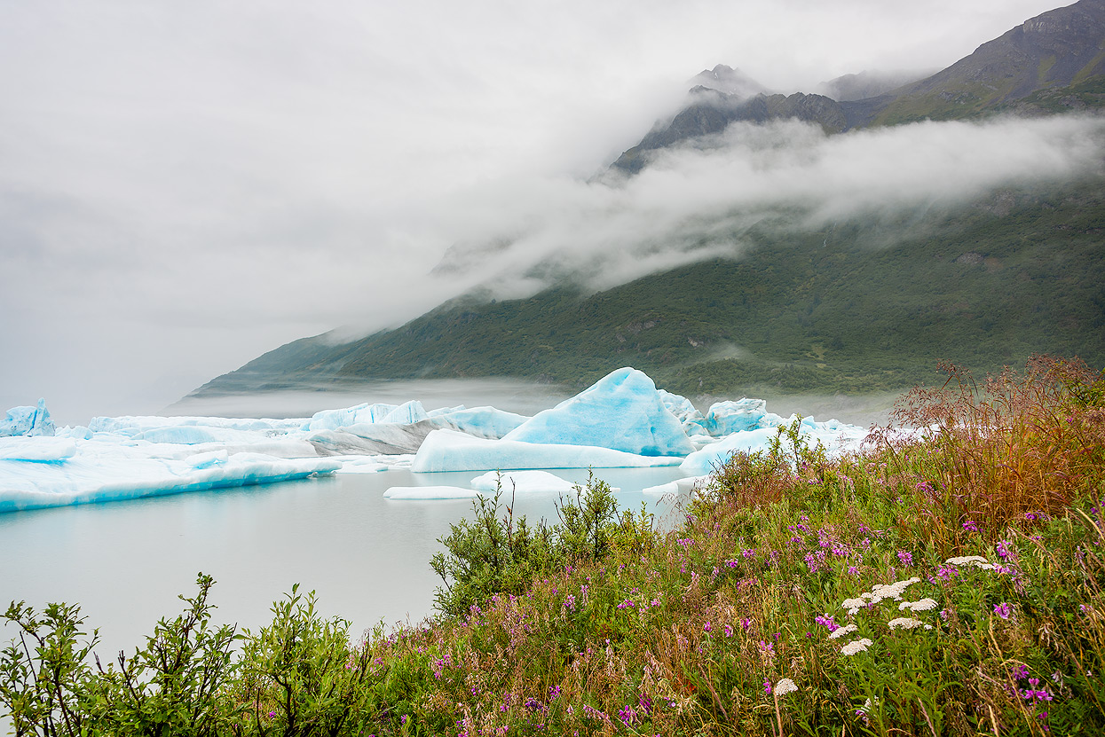
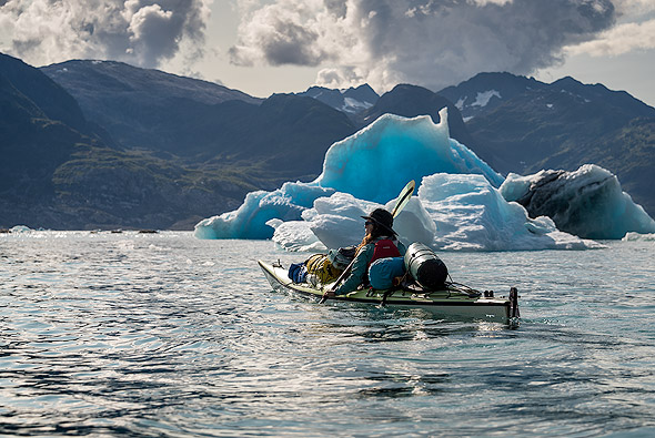
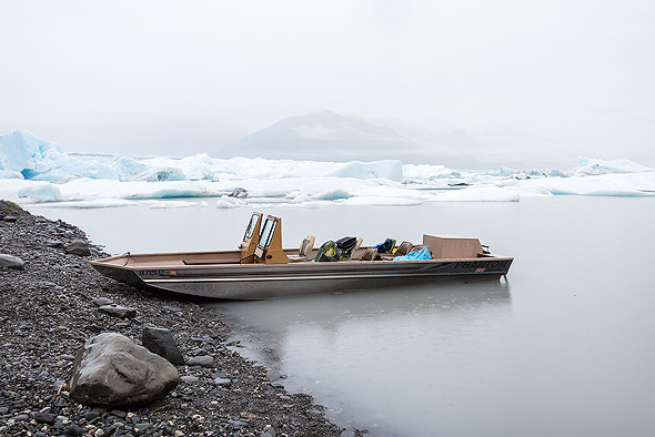
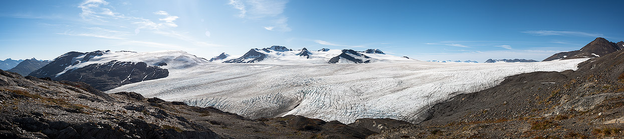
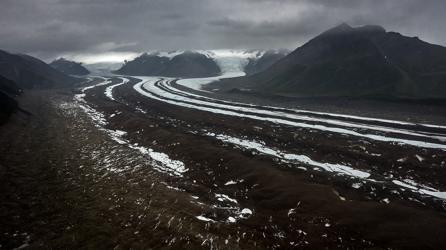
Columbia Glacier
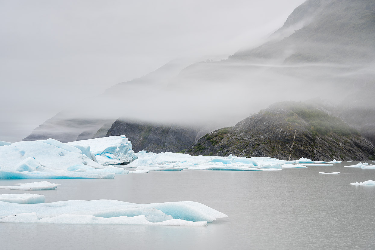
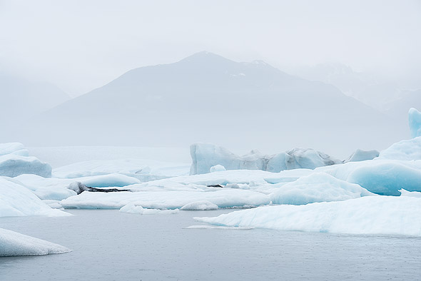
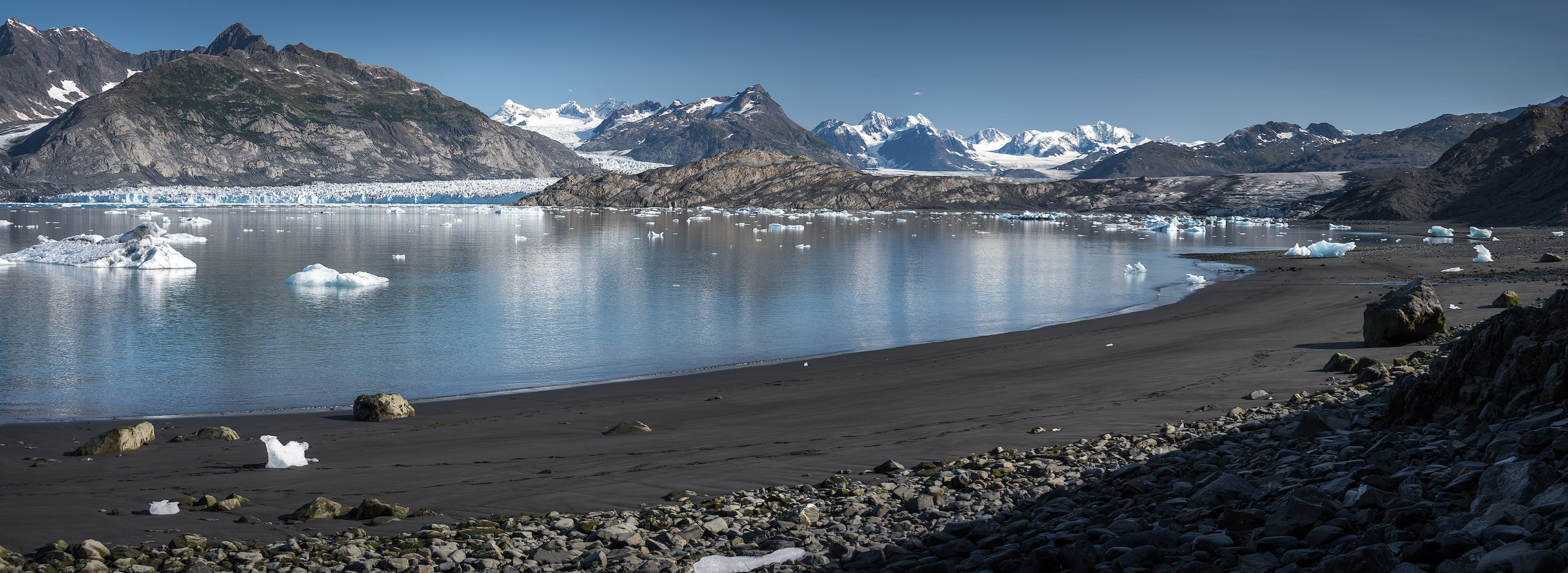
Columbia Glacier is a huge 680 square km glacier and is the subject of much study, because of its massive size and precipitous retreat. It has been called the fastest moving glacier in the world. Since the 1980’s it has gotten 400m thinner, although it is still enormous. When you study NASA pictures taken from space, they show that now is the time to take your children out to Columbia Glacier.
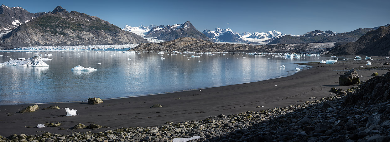
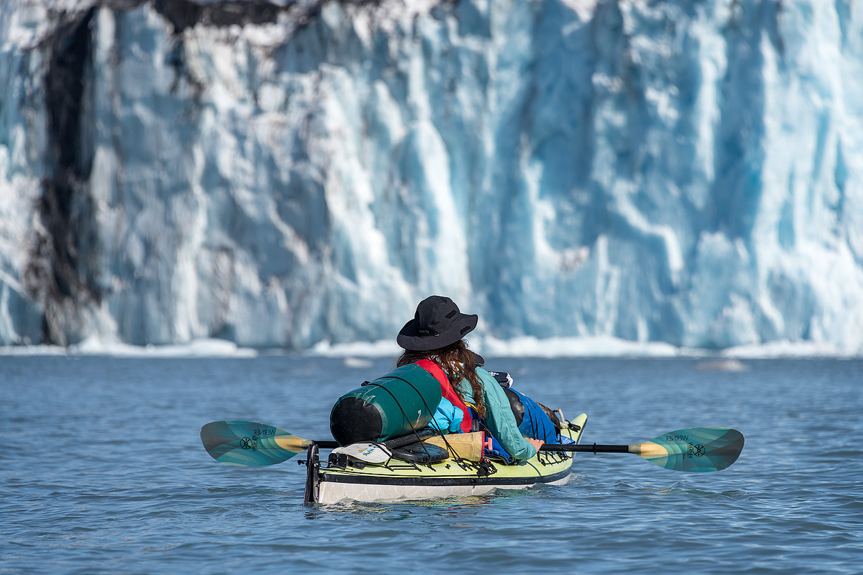
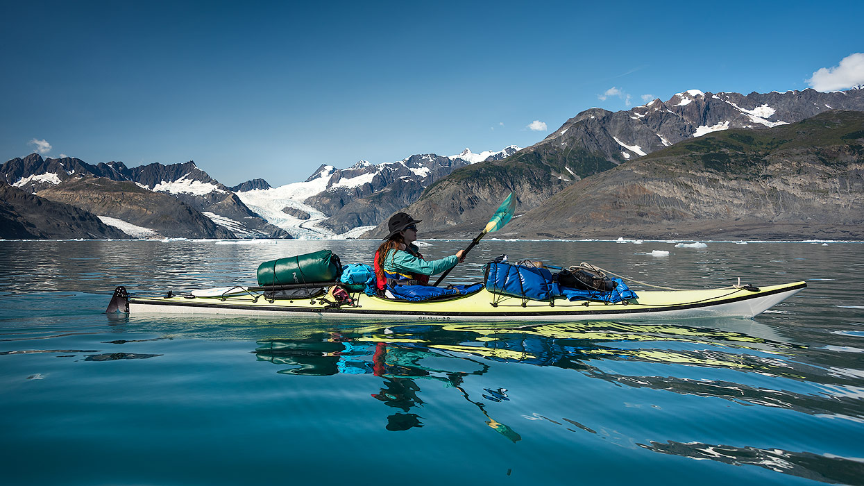
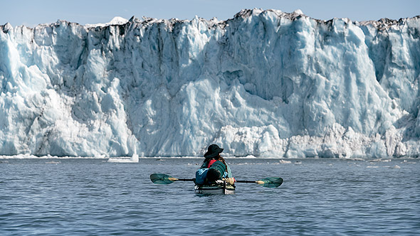
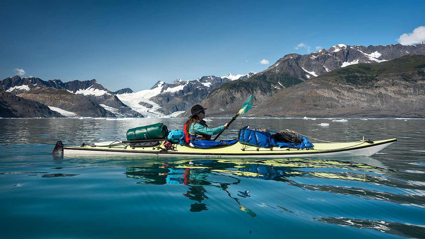
Columbia Glacier is the second largest tidewater glacier in North America, and spills forty miles out of the Chugach Mountains and ends with a three-mile wide face. Paddling here is known as ‘Bluewater’ kayaking, referring to the coastal areas characterised by extreme tidal fluctuations, cold water temperatures and high wind and rain. Sea kayaking in Prince William Sound, and in all coastal areas of Alaska isn’t like ocean touring – it requires careful attention to the tidal fluctuations and paddlers schedule days around the changing tides, travelling with the tidal current or during slack tide for easy paddling.
When paddling near the glaciers in Prince William Sound, you need to take extra care. Because of the danger of falling ice, you must stay half a mile away from the main flow to view it safely. Columbia Glacier is a slow moving river of ice, its face is four miles wide and over 270 feet high. It moves at about four feet per day carving and reshaping the land in its path.
Tidewater Glacier
A tidewater glacier is one that empties directly into the sea and the Columbia Glacier is the largest in Prince William Sound. The glacier was named after New York’s Columbia University and spills forty miles out of the Chugach Mountains. The Columbia Glacier has been rapidly retreating for almost ten years. Icebergs up to a million tons regularly break off, clogging the sea in the Sound with ice. Scientists predict that in fifty years, the Columbia Glacier will be half the size it is today.
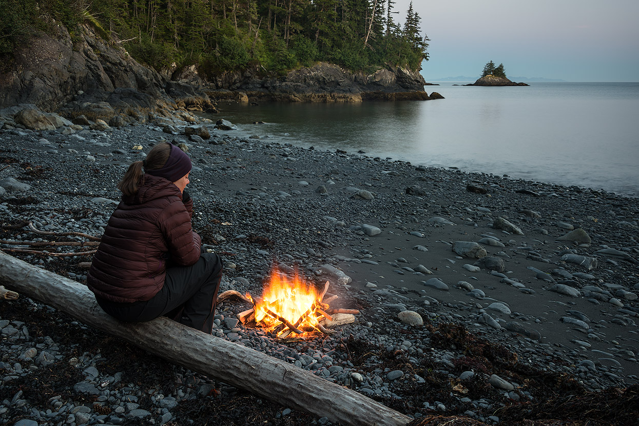
Multiday Kayak Camping Tour
We booked a three day kayaking tour by Pangaea. The tour is designed for anyone with a sense of adventure and ready to paddle amongst the wonderful shores, ice and marine life of the Prince William Sound. Paddling through the ice of the Columbia Glacier and on to the peaceful bays of Glacier Island was just amazing.

Marine mammal

Prince William Sound is an ideal place to see wildlife and paddling its waters offers a great chance to really get close up. If you are lucky, you’ll see bald eagles soaring overhead, kittiwakes nesting on the shores, brown bears feeding on the thousands of salmon that travel upstream to their summer spawning grounds. And in the water, there’s even more wildlife – the sea lion colony at Bull’s Head is great for watching the sea lions cavorting in the water and lazing about on the rocks. In fact, all of the sea lions in this colony are male.
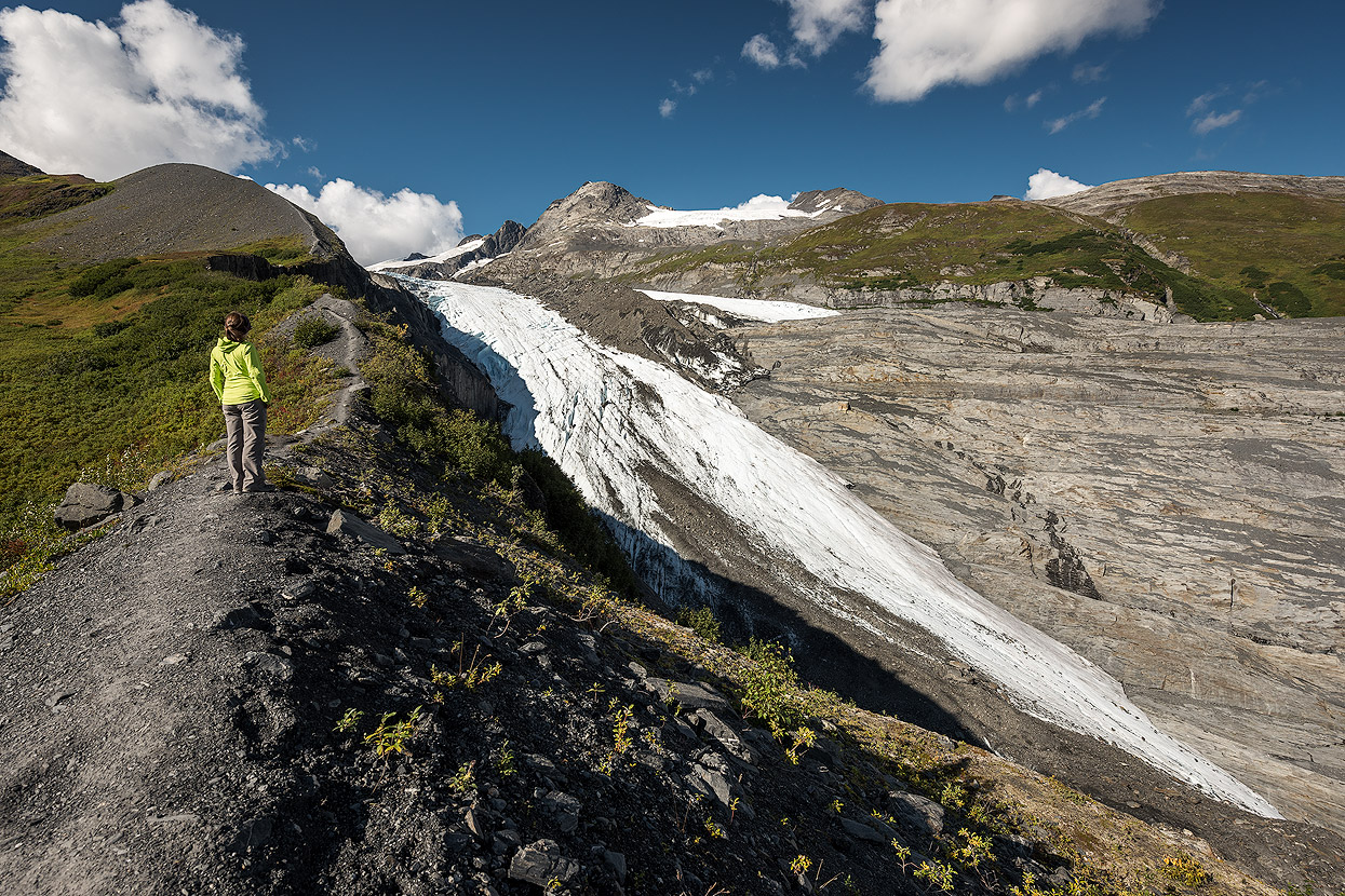
Worthington Glacier
Worthington Glacier is a roadside glacier with a day-use area in Thompson Pass. Not only is the glacier rapidly receding, but the treelike is moving higher up the pass as the climate warms.

The short and steep Worthington Glacier Ridge Trail starts at the Worthington Glacier State Park parking lot. Follow a well-defined trail through the alders and past a couple viewpoints and up a set of switchbacks to the alpine. Once on the ridge, follow it .25 miles to a reroute through an alder patch on your left and into a beautiful flowery valley. This reroute off the ridge bypasses dangerous unstable ground.
Connect back to the ridge proper on the large fin to gain spectacular views of Worthington Glacier and Thompson Pass. This is one of the most beautiful hikes in the state and allows for fast access to amazing road-side ice.
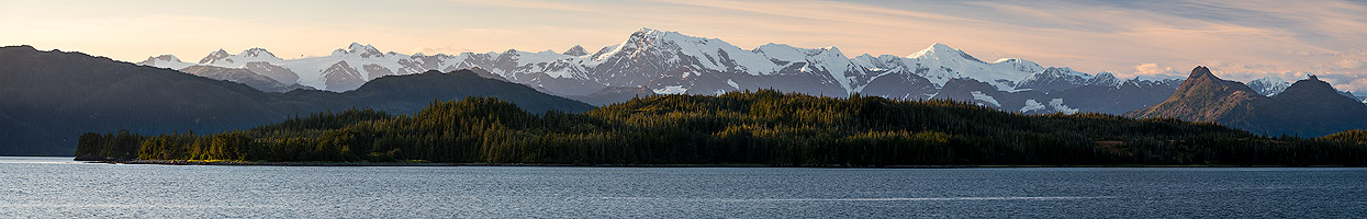
Chugach Mountains
Encompassing 9 distinct ecosystems, this wildlife-rich park stretches 200 coastal miles from Anchorage to Canada. Beyond the foothills at the edge of Alaska's largest city is Chugach State Park, the fourth-largest state park in the United States. While Alaska has wilderness areas that are larger and more biologically pristine than Chugach, no other wildlife-rich habitat on Earth is so close to a major city. The park is known for optimal accessibility and activities for adventurers of all skill-levels.

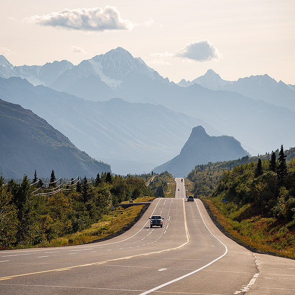
Glenn Highway
The Glenn Highway is a National Scenic Byway, surrounded by glaciers, mountains, and broad vistas. You might see goshawks, eagles, falcons, and Dall Sheep from the many pullouts and lookouts. As it winds through the Chugach and Talkeetna Mountains, past Palmer, the Glenn has breathtaking views of the Matanuska Glacier, the Matanuska River, and the cliffs and ravines nearby.

Knik Glacier
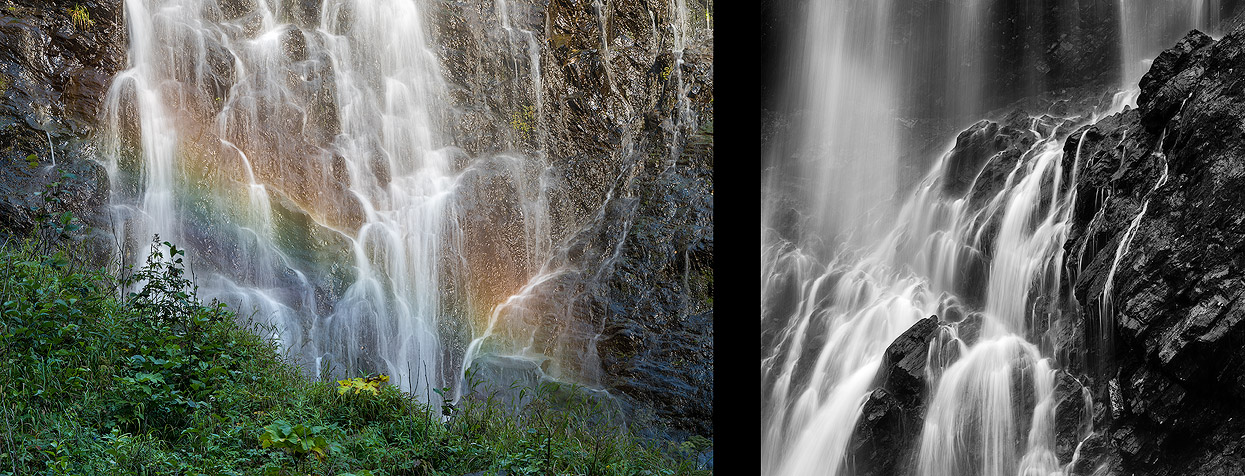
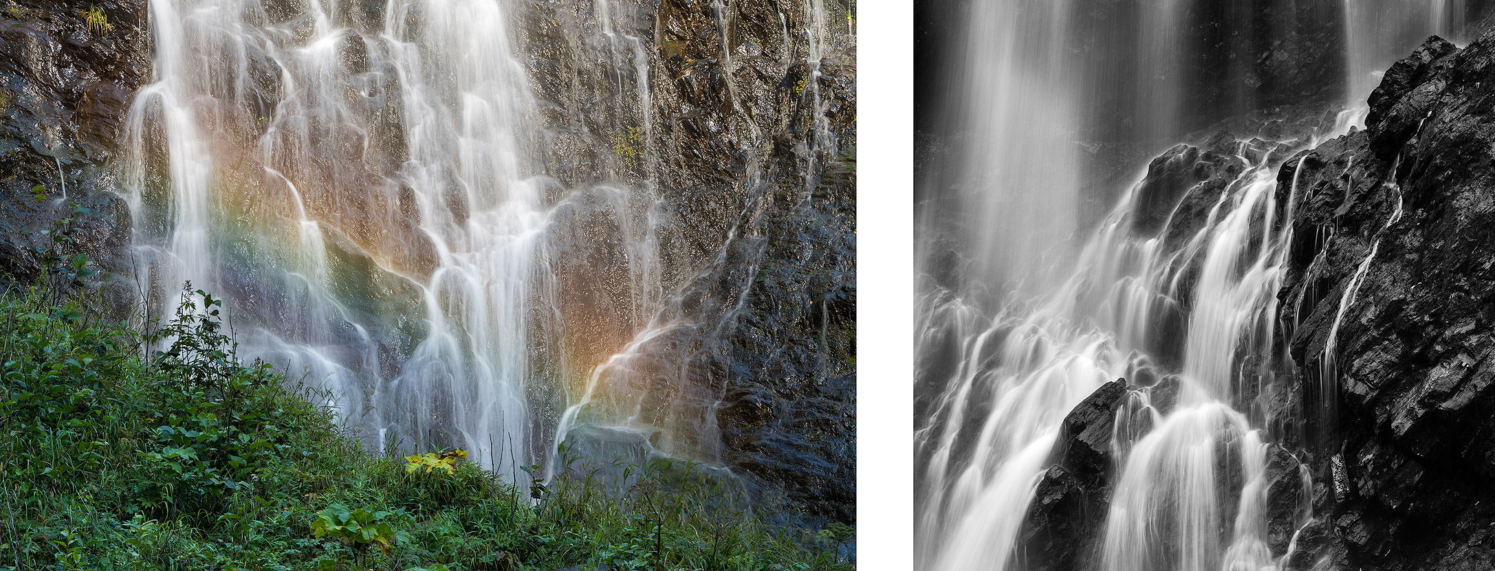
Knik Glacier is located on the northern edge of Alaska’s Chugach Mountains. Over 28 miles long and 5 miles across this is one of central Alaska’s greatest rivers of ice. Often referred to as Alaska’s ‘sunny glacier’, a unique microclimate or “rain shadow” has created a truly diverse ecosystem. A northern desert surrounded by snow covered peaks, hanging glaciers, and waterfalls.
To experience the Knik Glacier up close, you can either book a helicopter, ATV, or truck tour. Due to the bad weather, we opted for the monster truck tour, which was a good choice. We first rode on the truck through various streams until we boarded a boat. The lagoon at Knik Glacier was full of ice floes and we had a good view from a small hill nearby. The rainy and gloomy weather pleased the photographer in me, especially the clouds of mist passing by the Chugach Mountains and the blue icebergs were my favorite.
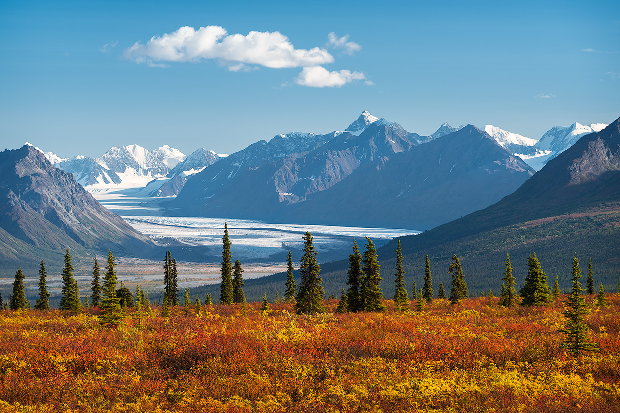
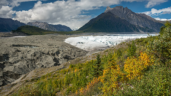
Matanuska Glacier
Matanuska Glacier, one of Alaska’s most accessible glaciers, is a stable 27-mile long river of ice flowing from the Chugach Mountains north almost to the Glenn Highway. With a four-mile wide terminus visible from one of Alaska’s major highways, the Matanuska Glacier is the most popular roadside attraction between Anchorage and Glennallen, and tourists flock to the area in the summer for the glacier’s brilliant views and epic treks.
Most visitors get close with the ice at Glacier Park, a private campground at Mile 102 of the Glenn Highway. A private road leads to a parking lot at the terminal moraine and from there visitors can access a 20-minute self-guided trail that takes them to the gravel-laced ice at the foot of the glacier.
To the south of Glacier Park is Matanuska Glacier State Recreation Site, a 229-acre recreation area located adjacent to the Glenn Highway at Mile 101. Although there is no direct access to the glacier, this state site provides some of the best views of the Matanuska Glacier and the headwaters of the Matanuska River. Visitors can take a 20 minutes stroll through the forested Edge Nature Trail to reach the glacier viewing platforms.
Kenai Peninsula
Kenai Fjords National Park lies south of Anchorage. There is something for everyone here: fishing at Cooper Landing or Homer, the glaciers at Harding Ice Field, kayaking in the numerous bays, and watching not only bears, moose, and sea eagles on land, but also orcas, fin whales, humpback whales, beluga whales, and minke whales in the water. The Turnagain Arm is one of only about 60 bays in the world which experiences tidal waves. Here, the tides can raise the water level by as much as 25 feet.
Turnagain Arm
The arm draws its name for British explorer James Cook, who was forced to “turn again” when the waterway didn’t hold the fabled Northwest Passage during his 1778 voyage. There’s no path through the continent, but there are plenty of reasons to go down the arm. Recognized as National Scenic Byway, the Seward Highway is a drive that is a destination too. Turnouts at Beluga Point, Windy Corner or Bird Point are perfect spots to view the Kenai and Chugach mountains and spot beluga whales and Dall sheep.
The bore tide, a wave of water that rushes down the arm and can top six feet tall, is an unusual, unforgettable sight. Formed by the area’s huge tidal range and focused in the narrow channel of Turnagain Arm, the bore tide tops speeds of 20 mph and even draws a few adventurous local surfers.
Harding Icefield & Exit Glacier
Exit Glacier earned its name when the first group of mountaineers to officially cross the Harding Icefield “exited” the ice at Exit Glacier. With 700 square miles of ice, the Harding Icefield is the largest one completely within the borders of the United States and among only four in the entire country.

A two-and-a-half hour drive from Anchorage, and only a 10-minute drive from Seward, the trail to the glacier is one of the best places to get a strong visual of the alarming effects of climate change and a chance to attempt to understand how glaciers affect landscapes. It's the only part of Kenai Fjords National Park that is accessible by road. And it's stunning.
The 8.2-mile out-and-back hike along Harding Icefield is a spectacular outing (Harding Ice Field Trail). The trail itself is only 3.8 miles out, but you'll need to access it via the Exit Glacier Paved Path, which adds to the overall distance. Hikers can expect sweeping views of the Exit Glacier area as they ascend high above the trailhead.

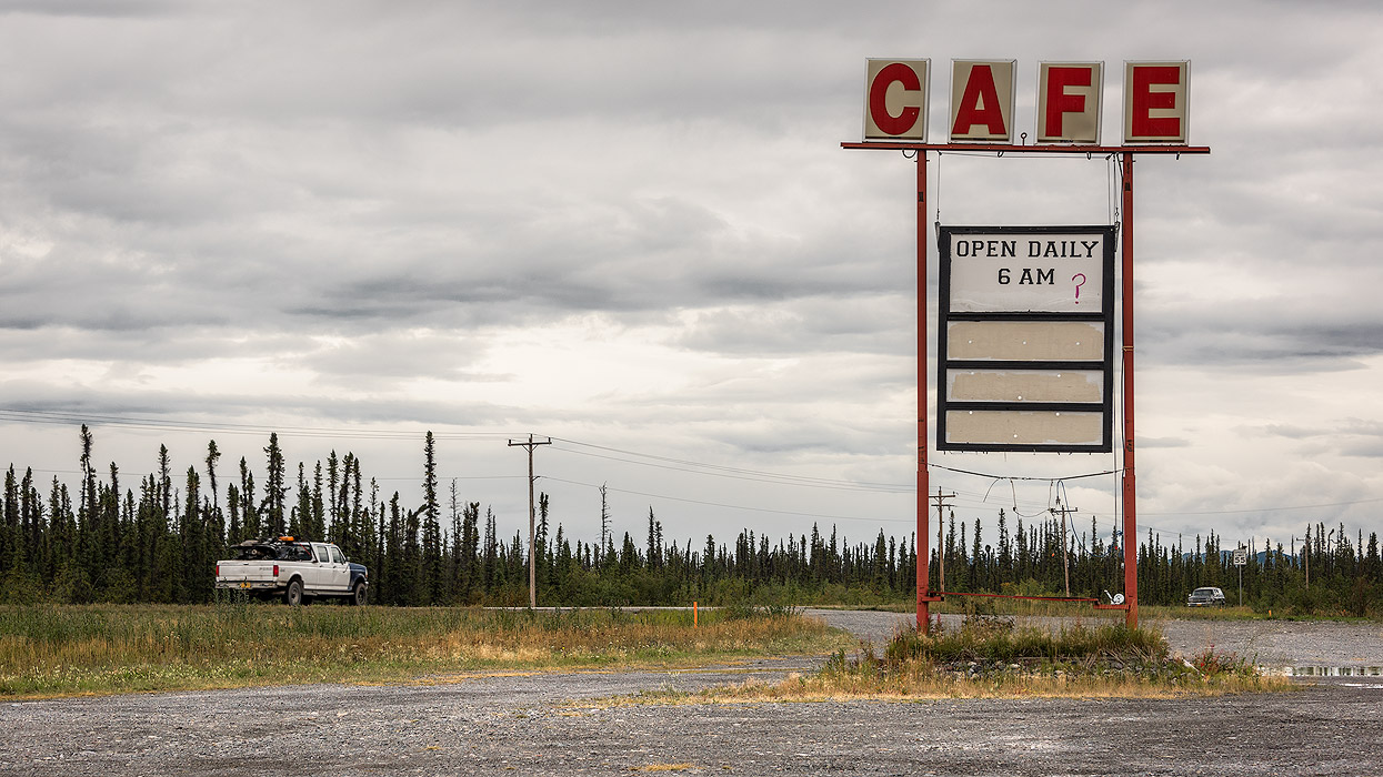
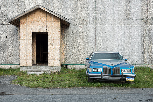
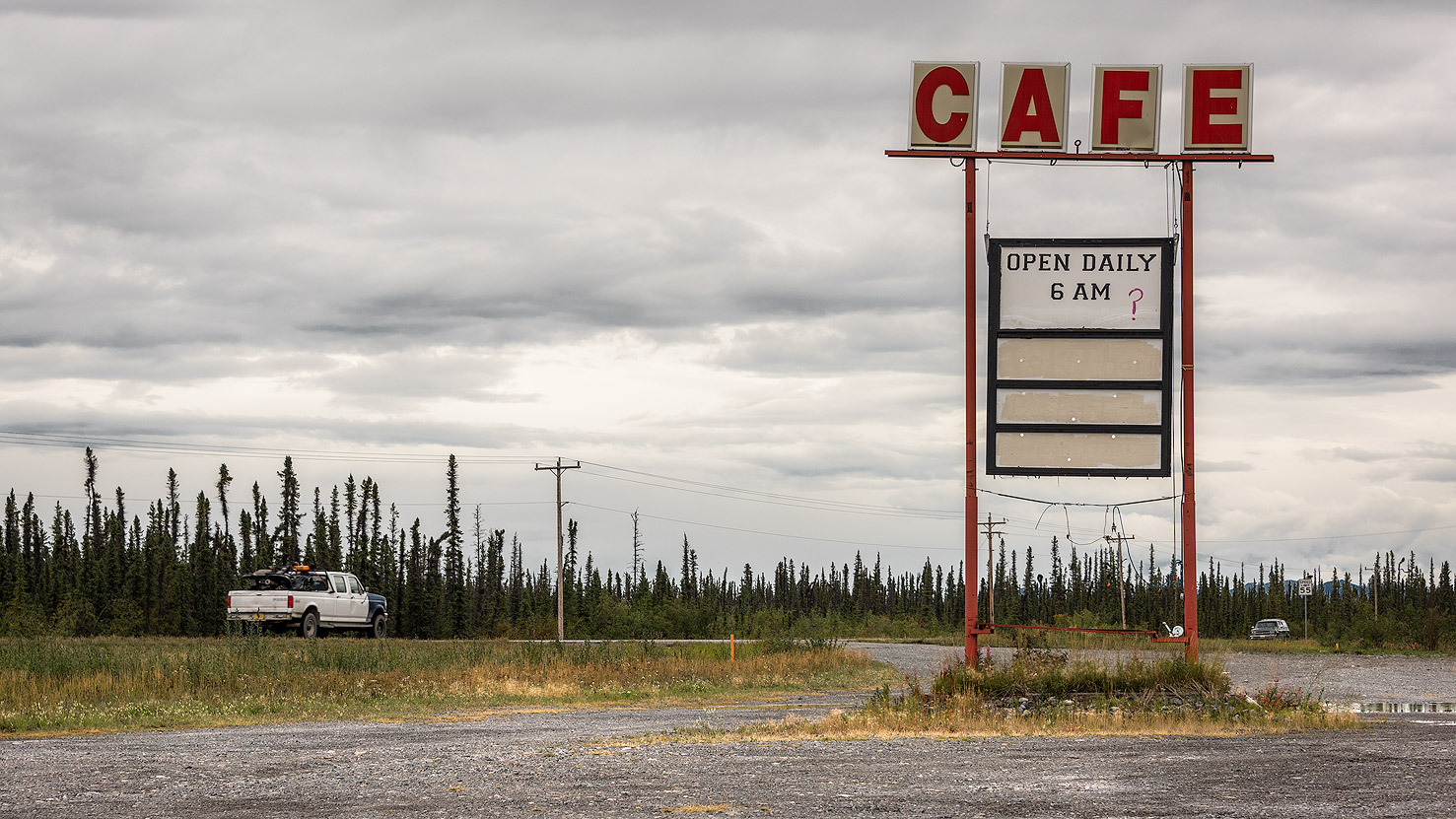
Everyday life in Alaska
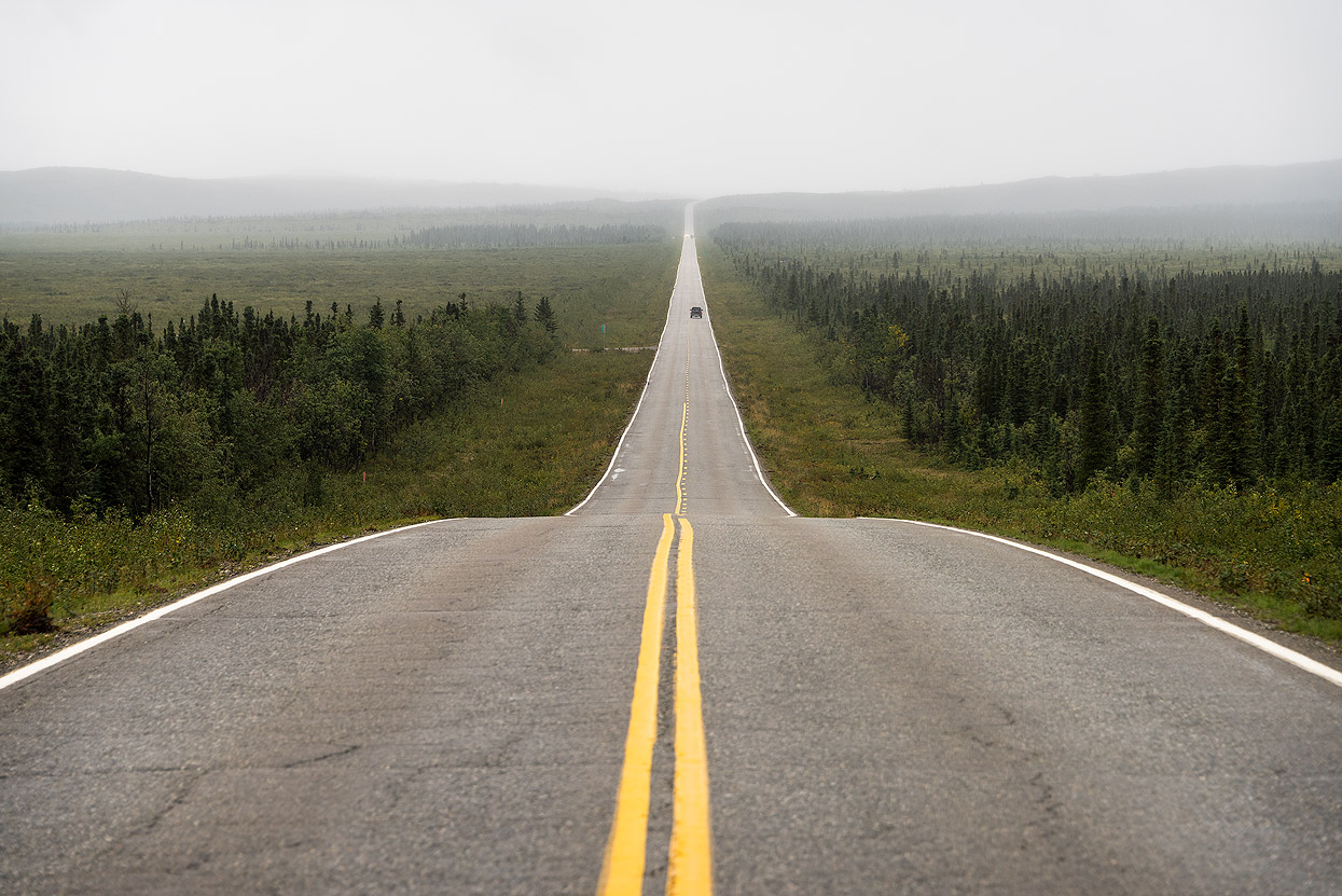
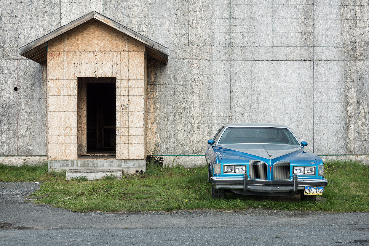
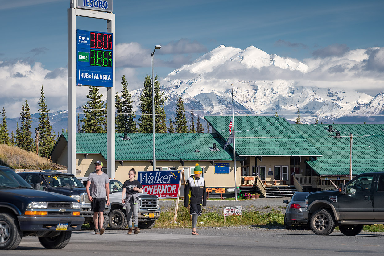
Even street photographers will find plenty to shoot in Alaska. The subjects are the same in almost every village: gas stations, churches, and houses where you're never quite sure whether they've been abandoned or still are home to someone.

Wildlife and sea life
When you think of Alaska, you also think of the diverse wildlife and sea life. You get the feeling that everyone in Alaska also hunts or goes fishing. Especially in the summer months, when the salmon swim back from the sea to their spawning grounds, not only are the bears happy, but also people who come from all over the world to fish these waters. Bears and moose are omnipresent. They are held in much respect and that's a good thing.
Moose
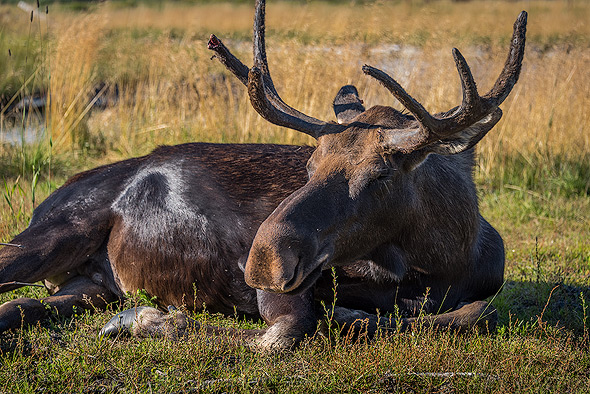
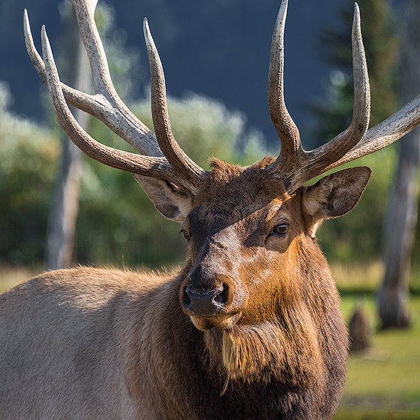
Moose are among the most popular photographic subjects in Alaska, and many people are surprised at how large they are. Males may weigh up to 1,600 pounds and stand over six-and-a-half feet tall. Babies usually stand within a day of birth, though their long, spindly legs make them fairly awkward. They are about 30 pounds at birth and can grow to 300 pounds or more within five months. Moose are the largest members of the deer family, and the variety of moose found in Alaska is the largest in the world. Males typically develop their largest racks at around age 10, and live to be about 16.
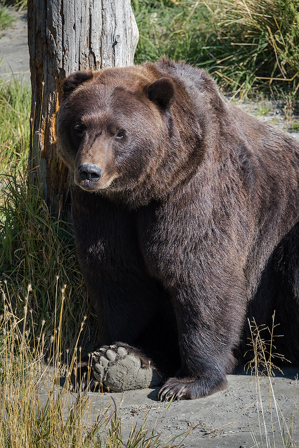
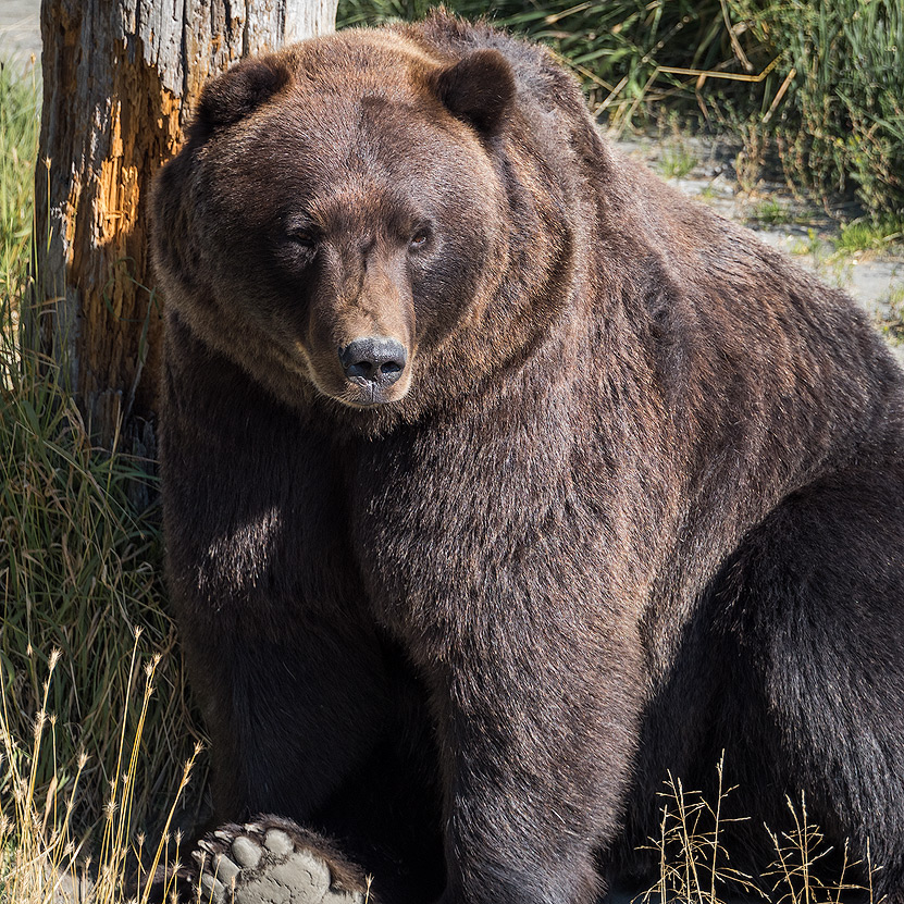
Brown Bears (Grizzlys)

Brown bears on Kodiak Island are classified as a distinct subspecies from those on the mainland because they are genetically and physically isolated. They even look different than their mainland relatives – the shape of their skulls is different and they tend to be larger on Kodiak Island, lending this subspecies its mythic reputation. Brown bears are much bigger than black bears, and seen side-by-side, it’s easy to tell them apart, even though both species come in a variety of colors, from black to light brown. Brown bears are also known as grizzlies, and these are the bears that are usually featured in Hollywood movies and in popular imagery of bears.
Black Bears
Black bears are the smallest of Alaska’s three bear species (the other two are grizzlies and polar bears) and have a pointier snout than grizzlies. Black bears aren’t always black, as strange as that may seem. Colors vary from white or creamy to brown or cinnamon. They spend their summers fattening up on salmon and berries, and can put on hundreds of pounds in the course of a few months.
Dall Sheep
Dall sheep are characterized by their curled horns, but if you look closely at their horns, you can also tell how old they are. The horns grow for three seasons and then stop in winter. The re-start of growth in spring causes a ridge to form on the horn, and you can count the ridges to tell how old the ram is. Rams with particularly large racks are said to be “full curl,” meaning they have an entire 360-degree turn in their horns. One of the most popular places to see Dall sheep is along the Seward Highway south of Anchorage. They are found many other places, but not usually so close to a major thoroughfare.
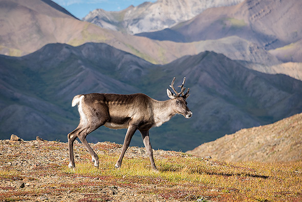
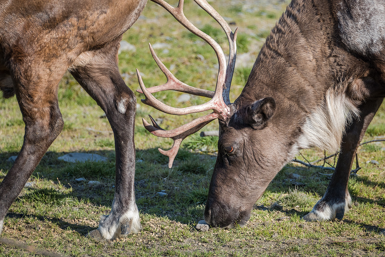
Caribou

Caribou are a member of the deer family and look a lot like their close relatives, the reindeer. They are the only members of the deer family in which both sexes grow antlers, though those of adult males are massive, while adult females have shorter, more slender and more irregular antlers. Both male and female caribou develop what is referred to as “velvet” on their antlers – an extra-soft layer of fur that they shed annually. Caribou migrate in large herds, and if they decide to cross a highway, it can take a long time to get where you want to go. Caribou in Alaska are distributed in 32 herds that include over 950,000 individuals.
Muskox

Muskoxen are prehistoric-looking animals with long coats that skim the ground and horns that curl toward their faces. They don’t just look prehistoric: it is believed that the ancestor of the muskoxen migrated to North America between 200,000 and 90,000 years ago. The underhair of muskoxen is called qiviut, and it is softer than cashmere. There are about 2,200 muskoxen in Alaska. In the summer, they gravitate toward river valleys to feast on sedges and grass, and in the winter they move to higher ground to avoid deep snow.
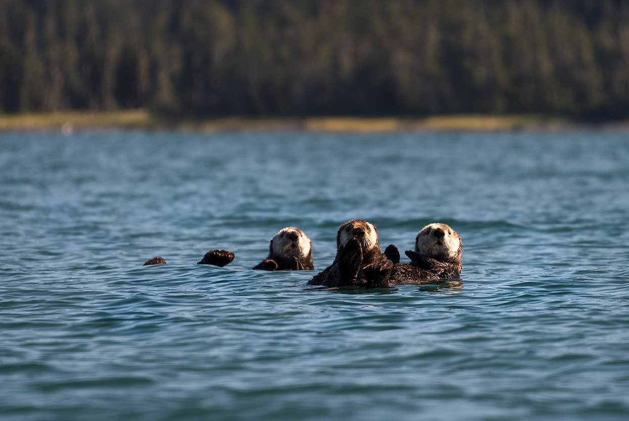
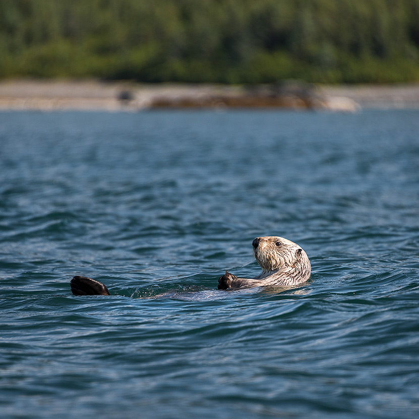
Sea otter
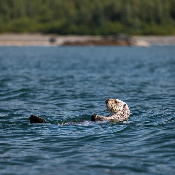
In many ways, the sea otter is responsible for the modern history of Alaska. Although they range as far south as California, early explorers had never seen them in such abundant quantities as they did in Alaska. Pelts brought to Russia after Vitus Bering’s 1742 voyage to Alaska prompted the Russians to sail to Alaska and set up fur-trading settlements throughout Alaska’s southern coastal region. The otters were hunted to near-extinction, but a treaty signed in 1911 marked the end of their decline. Sea otter populations in Alaska are now quite healthy. Unlike seals, they stay warm in Alaska’s cold waters not by storing a thick layer of blubber but by having dense underfur that traps air bubbles to keep them afloat and prevent them from becoming totally soaked. This adaptation is key to their survival, so they spend a lot of time grooming.
Harbor Seals
Harbor seals are also known as “hair seals” by some locals, and they are what brought the first white settlers to Alaska in the 1700s. Russians established a massive fur trade based on the pelts of harbor seals and nearly wiped them out completely, but since the Marine Mammal Protection Act, their numbers have rebounded and are now estimated at between 200,000-300,000. Harbor seals are mammals and therefore breathe air, but they are well adapted to life in the ocean. They can dive 600 feet below the surface and hold their breath for up to 20 minutes. Harbor seals’ diet would make most land-dwelling humans jealous. They spend their lives in Alaska feasting on walleye, pollock, Pacific cod, capelin, eulachon, Pacific herring, salmon, octopus and squid.
Wolves
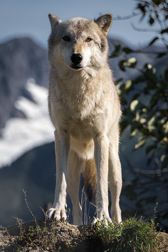
Anyone who has ever owned a dog has heard from trainers and other authorities how much dogs resemble their genetic forebears, the wolf. Like dogs, wolves are pack animals and their behavior within the pack is dictated by a highly structured hierarchy. Packs average around six to seven animals, and fighting within the pack is rare unless the animals are stressed or having a hard time finding food. Wolves are the source of a lot of mythological misunderstanding, but the truth is that wolves rarely attack humans and keep themselves pretty scarce when people are around. It is uncommon to spot a wolf, not because there aren’t plenty of them out there, but because they avoid people as much as they can. You will rarely see them along a highway or on a hiking trail.
Salmon
It’s hard to enumerate all the wonderful characteristics of Alaska’s most ubiquitous fish. Salmon are nutritious, delicious, abundant, fun to catch and easy to find just about anywhere you go in Alaska. The state of Alaska has banned fish farming in state waters, so all salmon that comes from Alaska is 100 percent wild and among the healthiest food available to man. There are five species of salmon in Alaska: king, silver, pink, chum and red. Some of the individual species, like red salmon from Alaska’s Copper River, have achieved boutique status in groceries around the country, but all of them are delicious. Part of the reason salmon are so tasty is because of the vigorous exercise they get in the process of spawning. Salmon are born in streams and then swim out to the ocean and spend their adolescence in the sea. When they are ready to reproduce, they head back to the stream or river of their birth to spawn, after which they die. Yukon River spawners bound for the extreme headwaters in Yukon Territory, Canada, will travel more than 2,000 river miles during a 60-day period.
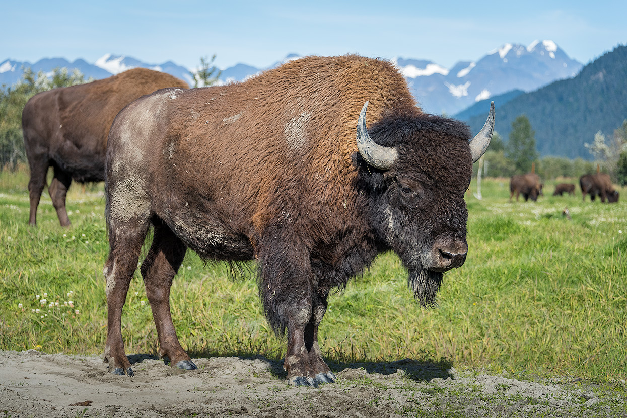
Alaska Wildlife Conservation Center (AWCC)
Sitting at the tip of the Turnagain Arm, an hour south of Anchorage, the Alaska Wildlife Conservation Center (AWCC) provides care to animals in need and give guests an in-depth look at Alaska’s amazing wildlife. Working with the Alaska Department of Fish and Game, the AWCC shelters animals that cannot survive on their own with hopes of releasing them back into the wild. In individual cases, however, some creatures either stay at the center or move to another facility. One of the center’s biggest projects involves the reintroduction of wood bison to the American wilderness. As the only wood bison herd in the U.S., the AWCC ensured the only birth of wood bison in Alaska for the last 100 years. From an original herd of 13, their numbers have since flourished to more than 70. You can visit the 65-acre enclosure to steal a view of these rare creatures. The other areas hold a variety of Alaskan wildlife, such as bear, moose, musk ox, eagles and coyotes. Many animals share the same enclosure, giving visitors a chance to see different species naturally interact with one another.
Looking back
For our first trip to Alaska, we chose some highlights which we enjoyed thanks to a bit of luck with the weather. We also drove about 1,700 miles over the three weeks. Next time, I think I'd rather drive a little less, but experience more!
You could spend several months in Alaska: there is so much to experience. My bucket list got bigger instead of smaller on this trip, but that's a good thing.
Backcountry Adventures im Wrangell-St. Elias Nationalpark
Alaska is a real hot spot for back country adventures: this is one place where you can experience true wilderness!
Unfortunately we only had two nights booked at Wrangell-St. Elias, much too short for a back country adventure which I have saved for my next visit. The best time for back country trekking is between the end of May and the beginning of August.
Arrigetch Peaks - Alatna Packraft im Gates of the Artic Nationalpark
After seeing photos of the Arrigetch Peaks for the first time, it was clear to me that I want to go there!
However, it’s not quite that easy, as the park is huge and completely undeveloped. The two-week pack raft and trekking tours promise a pure wilderness adventure!
Alaska Wildlife
Everybody knows the standard Alaska photos: bears standing in the rivers to catch the salmon as they swim upstream and fill their stomachs for the long winter. You can even more or less buy these photos: book a lodge in July at Brooks Falls in Katmai National Park and bring a 300 mm lens, Here you can the spectacle directly from the comfort of the lodge’s wooden terrace. Such a 2-3 day adventure costs several thousand dollars, but I’d personally rather spend it on a true back country adventure. I already watch the bears at Brooks Falls – via the webcams!
Wildlife photography in Alaska requires a lot of effort and the best equipment! I was aware of this, but because wildlife photography wasn’t really my focus, I simply photographed the animals whenever the opportunity arose. I didn’t wait for any bears or moose to show up and didn’t hike up the mountains to photograph the sheep. Maybe I will focus more on wildlife photography on the trip after my next one to Alaska. Until then, I’ll stick with the fantastic landscapes, unique giant glaciers, and impressive mountains!
But there is no question that seeing and experiencing bears in person is a one-of-a-kind experience.